Appendix C - Photographs of Representative Fuel Types in White Pine County Communities
Representative Fuel Types
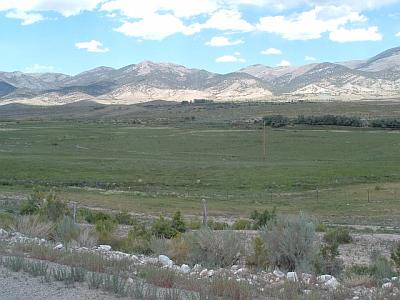
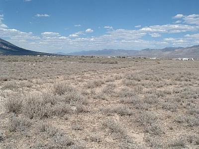
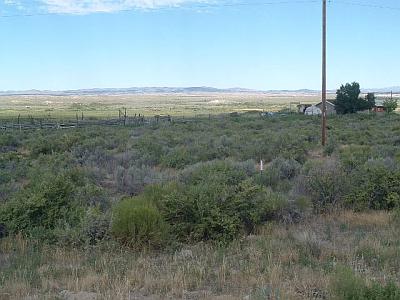
Photo 1. Lund, Pleasant Valley, Preston, Strawberry, and Shoshone. Agricultural lands in the valley bottoms near these communities function as fuelbreaks around many of the residences. Wyoming big sagebrush, rabbitbrush, and greasewood are the primary fuels on adjacent bottomlands and slopes
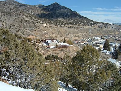
Photo 2. Blue Diamond, Baker, Cherry Creek, Cold Creek, Ely, and Ruth. Singleleaf pinyon and Utah juniper are the dominant species present near the wildland-urban interface areas of the above communities. Many stands are also intermixed with either Wyoming big sagebrush or black sagebrush. Fuels loads in this fuel type were estimated to range between six and fifteen tons per acre depending upon tree height and density. Pinyon-juniper fuel types were considered high to extreme fuel hazards.
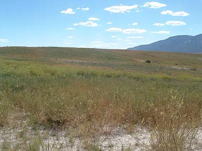
Photo 3. McGill. Alfalfa, sweet clover, and perennial grasses are the primary species present on the irrigated mine tailings west of the McGill community. Fuel loads were estimated at three tons per acre.
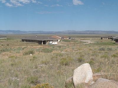
Photo 4. Great Basin National Park. Singleleaf pinyon, Utah juniper, and sagebrush are the primary species present at the lower elevations of the Park near the Park Service housing and visitor's center. Fuel loads were estimated at eight to fifteen tons per acre and were considered an extreme fuel hazard.
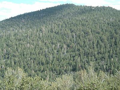
Photo 5. Great Basin National Park. Overstocked stands of mixed-conifer and subalpine tree species include ponderosa pine, white fir, Douglas fir, white bark pine, Engleman's spruce, and limber pine. White fir mortality has occurred in many areas of the Park due to the fir engraver beetle.
Photo 6. Lackawana and East Ely. Wyoming big sagebrush, black sagebrush, winterfat, halogeton and cheatgrass is present adjacent to homes in Lackawana and east Ely. Fuel loading was estimated at one to two tons per acre.
Photo 7. Goshute. Large fires have burned in some areas of the Goshute Indian Reservation. Rabbitbrush, snakeweed, and perennial grasses are the primary species that have established after fire. Fuel loads were estimated at less than one to two tons per acre.
Photo 8. Baker, Goshute, Lackawana, Pleasant Valley, and Preston. Vegetative fuels in these communities consist of big sagebrush, greasewood, and rabbitbrush, with halogeton and cheatgrass in the understory. In general, fuel loading were estimated at three to four tons per acre and considered a moderate to high fuel hazard.
Photo 9. East Cherry Creek, East Cold Creek, Ely, Lund, and Ruth. Sagebrush dominated fuels are present in some areas of the wildland-urban interface of each of the above communities. Wyoming big sagebrush, rabbitbrush, and perennial grasses are the primary species present. Fuel loads were estimated at two to four tons per acre depending upon shrub height and density.

