![]()
![]()
7.0 Fort Churchill - Weeks
7.1 Hazard and Risk Assessment
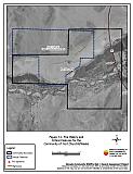
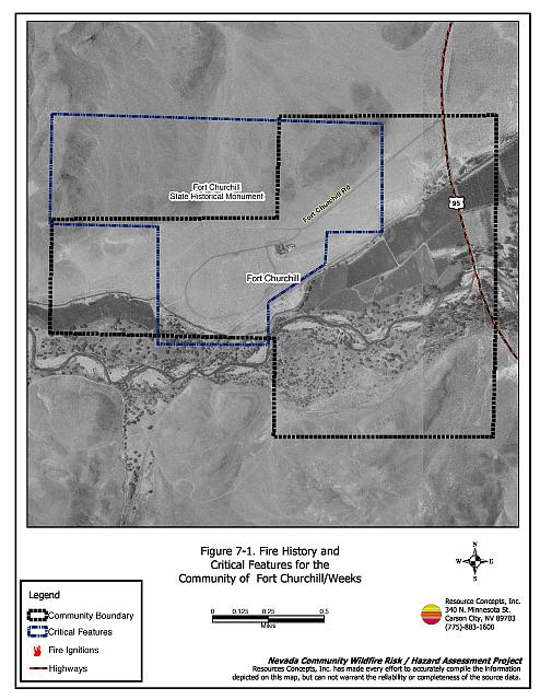
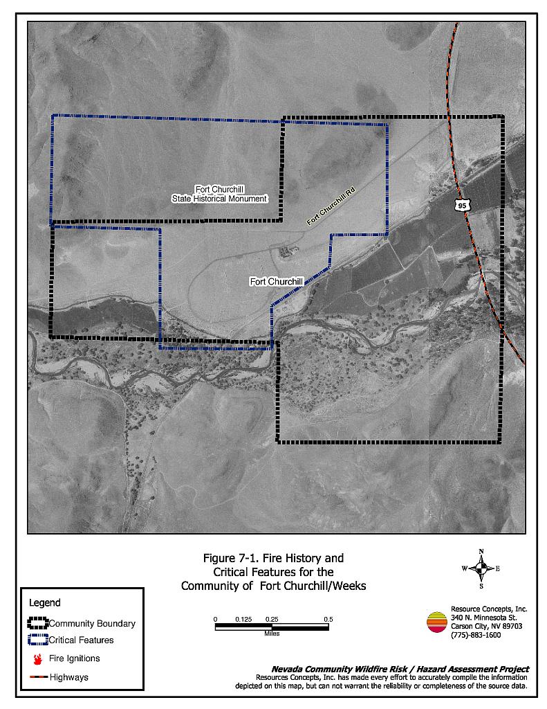
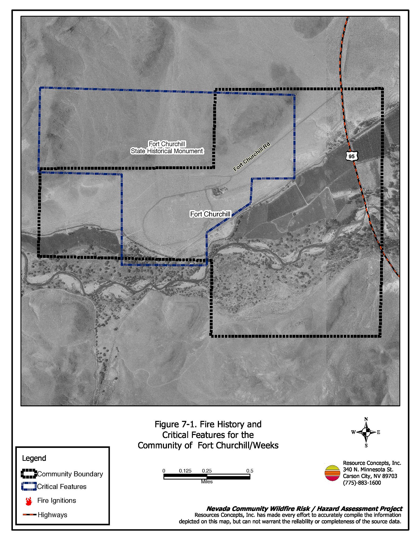
Fort Churchill - Weeks is not a typical community. It is a State Historical Monument of approximately 668 acres, located east of Silver Springs in north-central Lyon County (see Figure 7-1). Fort Churchill - Weeks is bordered by the Union Pacific Railroad and US Highway 95 to the east, Churchill Butte to the north, and the Carson River to the south. Three residences, located along Highway 95 in Weeks, were evaluated during the assessment. The risk/hazard assessment resulted in classifying Fort Churchill - Weeks in the Moderate Hazard category (58 points). The moderate community hazard rating is attributed primarily to the distance from fire suppression resources and flammable roofing materials on homes. The community wildfire hazard score sheet is provided at the end of this section. The specific findings for each of the wildland fire assessment parameters are reported below.
7.1.1 Community Design
The urban interface condition in Fort Churchill - Weeks is considered a rural community where residences are widely scattered and exposed to wildland fuels. Lot sizes are between one and ten acres. Residences are located along Highway 95 in Weeks.
Roads: The primary access route to the Fort Churchill - Weeks Monument is Fort Churchill Road, which intersects with US Highway 95. Fort Churchill Road is paved to the Monument and is unpaved gravel further west. US Highway 95 is the primary access route for the residences, and is a paved, two-lane highway. Both primary roads are greater than 24 feet wide, allowing adequate room for fire suppression equipment to maneuver.
Signage: Street signs and residential addresses were not visible for any of the homes surveyed. However, the community is small in size and all homes are easily visible from US Highway 95. There would be little chance of fire suppression personnel being unable to locate a particular structure that needed protection.
Utilities: The utilities that serve Fort Churchill - Weeks are primarily above ground, have adequately maintained right-of-ways, and pose only a low ignition risk to the community.
7.1.2 Construction Materials
All three of the homes observed in Weeks were built with fire resistant siding materials. One residence had a wood shingle roof whereas the other two were constructed with fire resistant roofing materials. One of the structures observed had an unenclosed deck that can create drafts where sparks and embers can be trapped, smolder, and ignite, rapidly spreading fire to the home.
7.1.3 Defensible Space
All three residences had landscaping that would meet the defensible space landscape requirement to protect the home from damage or minimize loss during a wildfire.
7.1.4 Suppression Capabilities
Wildfire Protection Resources
The Central Lyon County Fire Protection District provides wildfire protection. There is no established volunteer fire department in Fort Churchill or Weeks. Refer to Section 4.2 for more information on equipment and resource availability.
Water Sources and Infrastructure
Water availability for fire suppression in Fort Churchill - Weeks includes:
- Drafting sources and helicopter dip sites in the Carson River and irrigation ditches.
7.1.5 Factors Affecting Fire Behavior
The Carson River borders the Fort Churchill Monument and the residences to the south. Fuels along the river corridor included basin big sagebrush, black greasewood, and rabbitbrush. Shrub density was extremely high and formed a closed canopy. Ground fuels were comprised of saltgrass, bottlebrush squirreltail, and cheatgrass. The fuel load in this fuel type was estimated to be between two and five tons per acre and was considered a moderate fuel hazard. Mature stands of cottonwood made up the tree canopy layer.
Agricultural lands along the north side of the river provide a low fuel hazard buffer zone. Shrublands north of the agricultural lands consisted of greasewood, sagebrush, four-wing saltbush, and Nevada dalea. Bottlebrush squirreltail, Indian ricegrass and Russian thistle formed the ground fuel layer. The total fuel load was estimated to be less than one-half ton per acre and was classified as a low fuel hazard.
Fuels south of the Carson River were characterized by greasewood and sagebrush shrubs spaced between five and 20 feet apart. Indian ricegrass, cheatgrass, and Russian thistle comprised a sparse ground fuel layer. Fuels were estimated to be less than one-half ton per acre and were considered a low fuel hazard.
The terrain around the Fort Churchill - Weeks Monument area is mostly flat with slopes less than five percent. The predominant wind direction in the summer is from the west or southwest. Summer thunderstorms and associated erratic winds are common.
7.1.6 Fire Behavior Worst-case Scenario
A worst-case wildfire behavior scenario would be very unlikely to occur and has low potential for structure loss. The fuel is so widely spaced that only during a heavy cheatgrass production year, on a high hazard summer day, with winds greater than 30 miles per hour would a fire be able to spread. Flame lengths would be less than four feet in length and spread rates would likely approach 660 to 1,300 feet per hour. All of the residences are bordered to the south by agricultural land and would not likely be threatened by wildfire.
7.1.7 Ignition Risk Assessment
The Fort Churchill - Weeks area is viewed as having a low risk of human or lightning-caused fire ignitions and low potential for structure loss due to the sparse fuels in the area and the presence of agricultural land, which provides protection on the southwest and southeast sides of the residences. There is a slight risk of sparks igniting vegetation around the Union Pacific Railroad that borders the Monument and residences to the east.
7.2 Risk and Hazard Reduction Recommendations, Roles, and Responsibilities
The responsibility to keep a community fire safe falls not only on the local fire protection district but also on the residents of the community, businesses, and local governments. The recommendations for Fort Churchill - Weeks focus primarily on additional efforts that can be taken by community members and public agencies to increase wildland fire safety through reduction of fuels that pose a hazard. Other recommendations pertain to community coordination and public education efforts that could be undertaken to enhance fire safety. The recommendations are detailed below and summarized in Table 7-1.
7.2.1 Fuels Reduction Treatments
Following are some general fuel reduction treatments that should be implemented to reduce the potential fire hazard.
Union Pacific Railroad Responsibilities
- Reduce vegetation for a minimum distance of 15 feet along both sides of the railroad tracks.
7.2.2 Public Education
Public education focused on increasing community fire safety is critical. Informed community members can provide the leadership necessary to initiate efforts to effectively reduce the threat that wildland fires present to the entire interface community.
Central Lyon County Fire Protection District Responsibilities
- Distribute copies of the publication Living with Fire to all property owners. This publication is free of charge. Copies can be requested from the University of Nevada Cooperative Extension.
7.3 Summary of Recommendations
| Responsible Party | Recommended Treatment | Recommendation Description |
|---|---|---|
| Union Pacific Railroad | Fuel Reduction Treatments | Reduce vegetation for a minimum distance of 15 feet on both sides of the railroad tracks. |
| Central Lyon County Fire Protection District | Public Education | Distribute copies of the publication Living with Fire to all property owners. |
Figure 7-1Fire History and Critical Features for the Community of Fort Churchill - Weeks |
 |
Fort Churchill - Weeks Wildfire Hazard Rating Summary |
 |