![]()
![]()
11.0 Grass Valley
11.1 Grass Valley Risk/Hazard Assessment
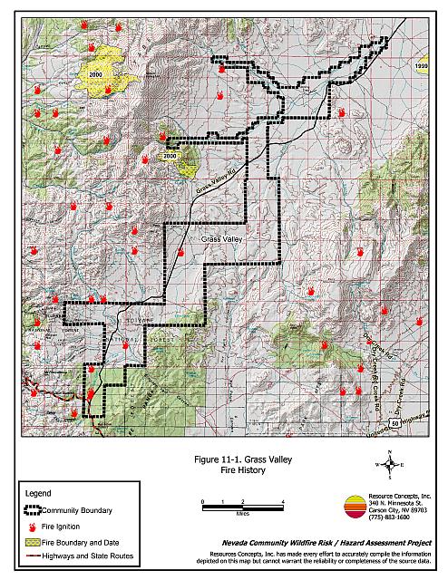
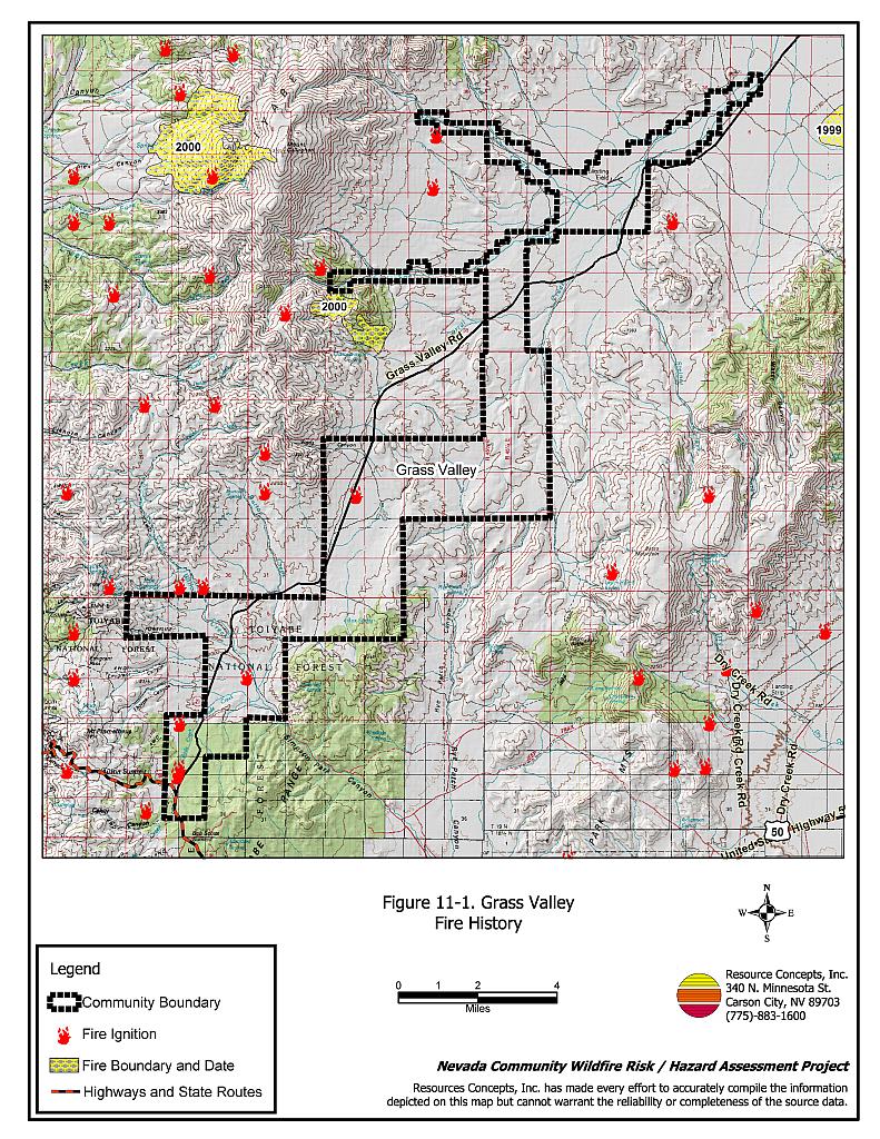
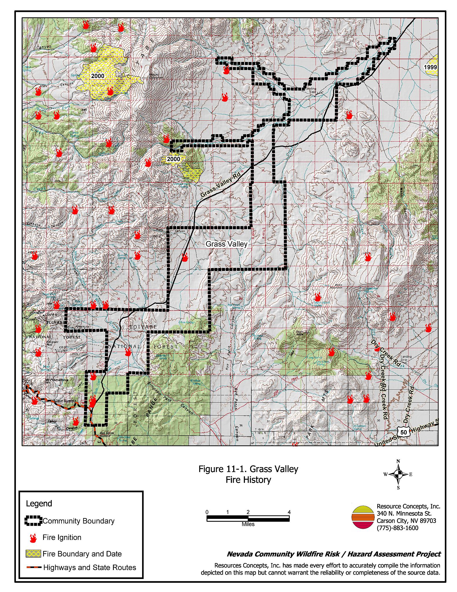
Grass Valley is located in eastern Lander County, isolated from any major transportation routes or other communities. The valley is bound to the west by the Toiyabe Mountains, and to the east by the Simpson Park Mountains. The portion of Grass Valley that lies within Lander County is shown in Figure 11-1. Grass Valley is a rural ranch community composed of widely spaced ranches interspersed with large tracts of agricultural or public lands. The rural ranch community type does not lend itself to the standard community assessment procedures. Defensible space, suppression resources, and fuel hazard conditions are described qualitatively for the community.
11.1.1 Community Design
There were six ranches noted in Grass Valley, all on parcels of greater than ten acres.
11.1.2 Construction Materials
This element of the risk/hazard assessment was not completed for residences in Grass Valley. Agricultural fields abut the residential properties and the risk of a wildland fire spreading to residences is low.
11.1.3 Defensible Space
Rural homes are generally surrounded by landscaped yards, corrals, or agricultural pastures with no wildland vegetation in close proximity to structures. These characteristics usually contribute to a low risk of damage or direct loss of property due to wildfires. Hay and alfalfa fields, haystacks, livestock feed yards, farming equipment storage areas, and fuel tanks require special attention when establishing defensible space for protection during a wildfire. Many such areas may not meet recommendations intended to minimize the potential for damage or loss during a wildfire.
11.1.4 Suppression Capabilities
Wildfire Protection Resources
The closest suppression resources for Grass Valley are located in Austin, approximately 25 miles away. The Austin Volunteer Fire Department and the Battle Mountain BLM Field Office respond to wildland fires in Grass Valley, with US Forest Service Austin Ranger District and Nevada Division of Forestry resources available as necessary. Table 11-1 provides a summary of fire suppression resources potentially available to respond to a wildland fire in the Grass Valley area. It is important to note that the actual number and type of suppression resources available to respond from neighboring fire departments and agencies is dependent upon the resources on hand at the time of the wildland fire call.
| Type of Equipment | Amount of Equipment | Cooperating Partner (Resource Location) |
|---|---|---|
| Type 1 Engine Type 3 Engine Type 1 Water Tender |
1 1 2 |
Austin Volunteer Fire Department (Austin) |
| Type 3 Engine Water Tender |
1 1 |
US Forest Service / BLM Interagency (Austin) |
| Type 3 Engine Type 4 Engine |
1 1 |
BLM Battle Mountain Field Office (Battle Mountain) |
| Hand Crew (Type 2- Trained) | 3 | Nevada Division of Forestry Conservation Camp (Tonopah) |
| Source: Chad Lewis, Donovan Walker, and Dave Davis, BLM Battle Mountain Field Office; Mike Pattison, Interagency FMO Austin; Kacey KC, NDF State Office; Butch Hayes, BLM Nevada State Office. | ||
Water Sources and Infrastructure
Water sources include irrigation wells and ranch ponds.
Detection and Communication
In Grass Valley fires are reported through 911 calls to the Lander County Sheriff’s Office. Fires are communicated to local volunteer fire departments by the Lander County Sheriff’s Office using radios and pagers. Fires are communicated to federal agency fire personnel by the Central Nevada Interagency Dispatch Center. Nevada Division of Forestry fire crews are dispatched from the Sierra Front Interagency Dispatch Center or the Elko Interagency Dispatch Center.
11.1.5 Factors That Affect Fire Behavior
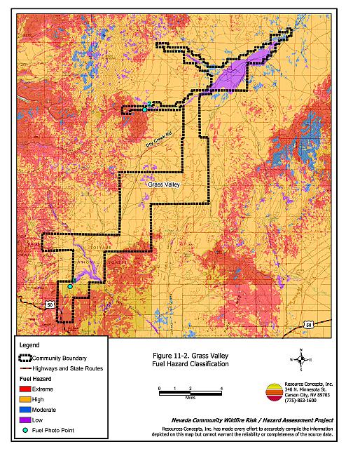
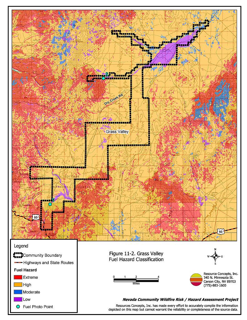
The predominant wind direction in Grass Valley is from the west/southwest in the afternoon. The fuel conditions vary with changes in elevation. The low lands are typically agricultural fields or greasewood flats and the associated fuel hazard is low. Beyond the flats and agricultural fields, the rangelands become steeper and the hills are shrub dominated with sagebrush, rabbitbrush, and other brush as the primary fuel types. Encroaching pinyon and juniper create high fuel hazard conditions. As the hills become steeper, the density of pinyon and juniper trees increases and creates extreme fuel hazard conditions. Cheatgrass can be found throughout most areas and will increase the fuel hazard even more in years of above normal precipitation. Ground fuels, ladder fuels, and a tree layer provide the potential conditions for a hazardous crown fire. Figures 11-2 shows the general fuel hazard conditions in Grass Valley. Figure 11-3 shows examples of agricultural and rangeland conditions in the community.
11.1.6 Worst-Case Wildfire Scenario
The worst-case scenario for a wildland fire in Grass Valley would occur west of the community in a wet year with abundant cheatgrass production. An ignition from a dry lightning strike in the surrounding hills would easily ignite cheatgrass and easily be carried through the shrub layer. Downslope winds would drive the fire into the valley. However, as the fire approached the agricultural fields the low fuel condition would cause the fire to slow once it reached the agricultural-wildland interface. Only the ranch improvements located near the interface would be at risk of damage or loss.
11.1.7 Ignition Risks
There is a high potential for ignition from lightning in Grass Valley, and human caused ignitions can occur at any time. There is some ignition history in Grass Valley, and extensive wildfire history to the east.
11.2 Hazard Reduction Recommendations
Despite the reduced risk of damage or loss to structural properties, residences in Grass Valley exhibit unique conditions because of their remote location and relative isolation. Hay and alfalfa fields, stockpiled bales, livestock, ranching and farming equipment, and fuel tanks are assets that require special protection because of their considerable value to ranchers and farmers. Not only can stockpiled hay combust or ignite easily, but smoke can make the hay unpalatable and unusable for livestock feed.
11.2.1 Defensible Space Treatments
Property Owner Recommendations
- Remove, reduce, and replace vegetation around homes and outbuildings according to guidelines provided in Appendix E. This area should be kept:
- Lean: There are only small amounts of flammable vegetation.
- Clean: There is no accumulation of dead vegetation or other flammable material including woodpiles.
- Green: Existing plants are healthy and green during the fire season. Irrigate all trees and large shrubs in close proximity to structures to increase their fire resiliency. This is especially important during drought conditions.
- Immediately remove cleared vegetation to an approved disposal site. This material dries quickly and poses a fire risk if left on site.
- Keep the area beneath unenclosed porches and decks free of accumulated vegetation or other flammable debris. Screen or enclose these areas where possible.
- Where cheatgrass has become dominant within the defensible space zone, the plants should be mowed, raked, and removed prior to seed maturity or treated with an application of pre-emergent herbicide prior to initiation of the growing season. Treatments may need to be repeated for several years to ensure that the seed bank of unwanted annual grass seed has been depleted. Refer to Appendix E for seeding recommendations and planting guidelines that can be used in conjunction with cheatgrass removal.
- Create a firebreak of bare ground or gravel for 100 feet around hay storage areas. Because it is dried plant material, stacked or baled hay is vulnerable to ignitions, as much from internal combustion as from outside sources.
- Plant fire-resistant vegetation in the defensible space area around residential structures and outbuildings. This will enhance fire abatement, especially important in rural areas where water sources are limited or distant.
- Clear a minimum ten-foot area around fuel tanks.
- Maintain defensible space areas annually.
11.2.2 Fire Suppression
Property Owner Recommendations
- Establish backup power systems to assure that functional water sources are available for fire suppression.
- Develop water storage for fire protection and install water outlets with fire department threads on new and existing water developments for filling water tenders and engines. Pursue grant funding as it becomes available to assist with financing these improvements.
Lander County
- Identify a minimum of four people from Grass Valley who would be likely to provide the initial response to a nearby ignition and coordinate with the Bureau of Land Management, the Nevada Fire Marshall, or the Nevada Division of Forestry to provide them with Basic Wildland Firefighter Training.
- Pursue grant funding and station a pick-up truck and a one-piece, slip-on, 100 to 200-gallon tank and pump unit with hose and hose reel in Grass Valley during the fire season. This equipment, fitted properly for the size and weight limitations of the truck, can be used to provide initial attack of small wildfire ignitions.
Bureau of Land Management
- Continue to plan and implement greenstrip projects to slow the spread of a wildfire and allow more time for the arrival of suppression resources.
11.2.3 Public Education and Community Coordination
University of Nevada Cooperative Education
- Develop a version of the “Living With Fire” publication tailored to the concerns of rural Nevada ranchers. The publication should include solutions for power back up, foam and other fire retardant products, fire resistant seeding, water storage adaptations for filling fire engines and water tenders, and suggested site plans.
| Involved Party | Recommended Treatment | Recommendation Description |
|---|---|---|
| Property Owners | Defensible Space Treatments | Remove, reduce, and replace vegetation around homes according to the guidelines in Appendix E. Maintain defensible space as needed to keep the space lean, clean, and green. |
| Fire Suppression | Provide back-up power systems to assure water availability for fire suppression. Develop water storage for fire protection and adapt new and existing water developments for filling water tenders and engines. |
|
| Lander County | Fire Suppression | Identify at least four people who would be likely to provide the initial response to a nearby ignition and coordinate with the fire agencies to provide Basic Wildland Firefighter training. Pursue grant funding and station a pick-up truck fitted with a 100 to 200 gallon tank, pump, and hose in Grass Valley during the fire season. |
| University of Nevada Cooperative Extension | Public Education | Develop a rural version of “Living With Fire” tailored to the needs of rural ranch communities. |
| Bureau of Land Management | Fire Suppression | Continue to plan and implement greenstrip projects to slow the spread of a wildfire and allow more time for the arrival of suppression resources. |
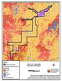
Figure 11-1Grass Valley Fire History |
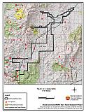 |
Figure 11-2Grass Valley Fuel Hazard Classification |
 |
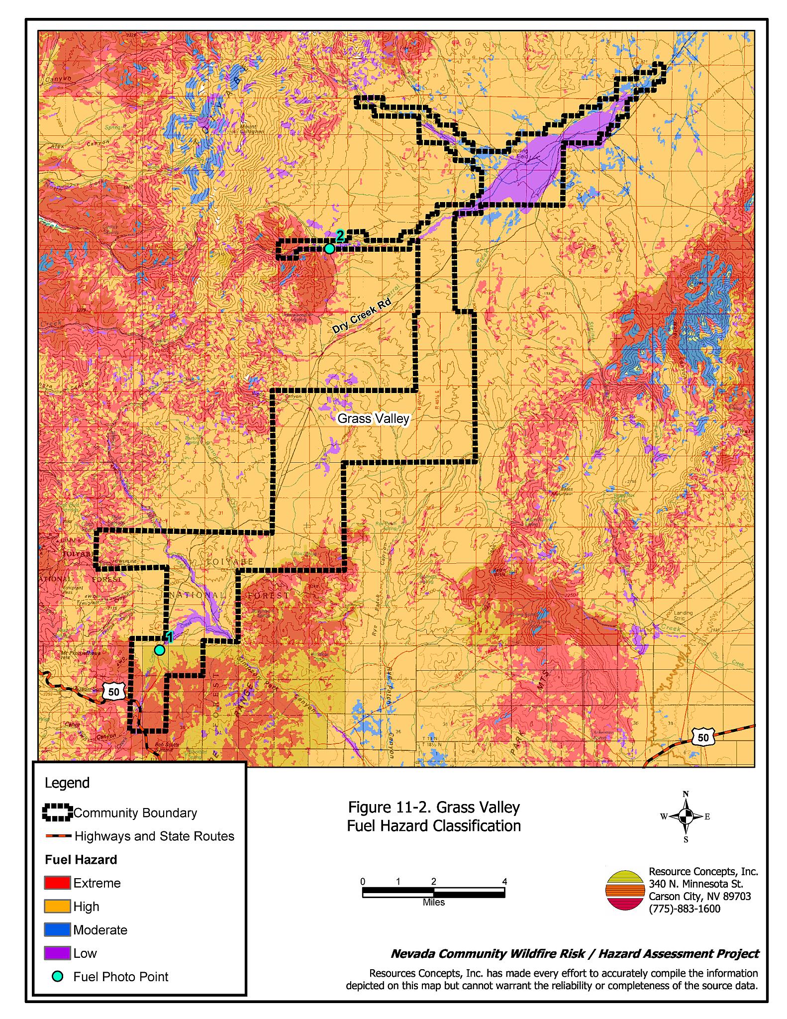
Figure 11-3 Grass Valley Fuel Hazard Photo Points
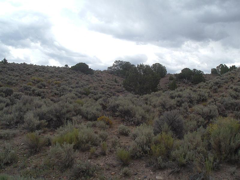
Photo Point 1. 4372058N, 500712E, East. Vegetation in Grass Valley consists of sagebrush, rabbitbrush, and a tree layer of pinyon-juniper that increases the fuel hazard. The cheatgrass component throughout the valley, and rolling hills in the south end of the valley, increase the fuel loading and hazard.
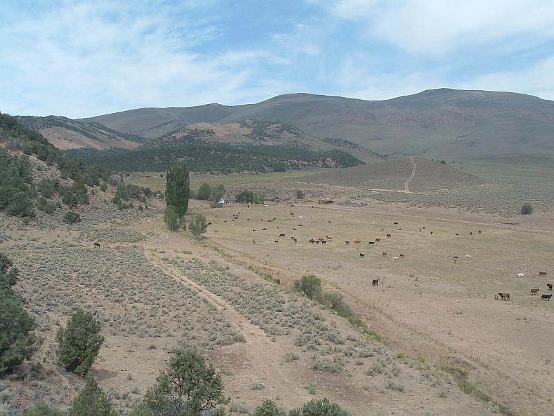
Photo Point 2. 4390218N, 508408E, 300°NW. A typical ranch setting in Grass Valley. Note the slopes, pinyon-juniper trees, and isolated residence.