![]()
![]()
Risk/Hazard Identification and Mitigation Project Worksheet
Name of Community: Logan Shoals
Date: July, 2004
Project Title: Logan Shoals Unit 1 - Thinning and Brush Removal; WUI Fuelbreak
Description of Risk/Hazard: Describe in detail the risk or hazard that poses a threat to the community.
Vegetative Fuel and Topography: The Logan Shoals Unit 1 is characterized by patchy vegetative cover, with open to dense stands of Jeffery pine and white fir. The understory is brush that becomes very heavy and dense in open areas. Jeffery pine in open areas is heavily infected with dwarf mistletoe. The basal area per acre varies from 40 (well spaced) to 220 (heavy overstocked) square feet.
Worst Case Scenario / Hazard: A wind driven downslope fire event would be difficult to control and threaten structures and Highway 50.
Priority Ranking: What is the priority ranking of this risk/hazard in relation to all others identified?
Because fuels are lower and mostly not up wind of the community, this project ranks as #14 for the TDFPD.
Location: Describe or attach a map with sufficient detail to allow accurate ground location.
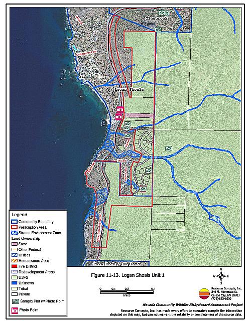
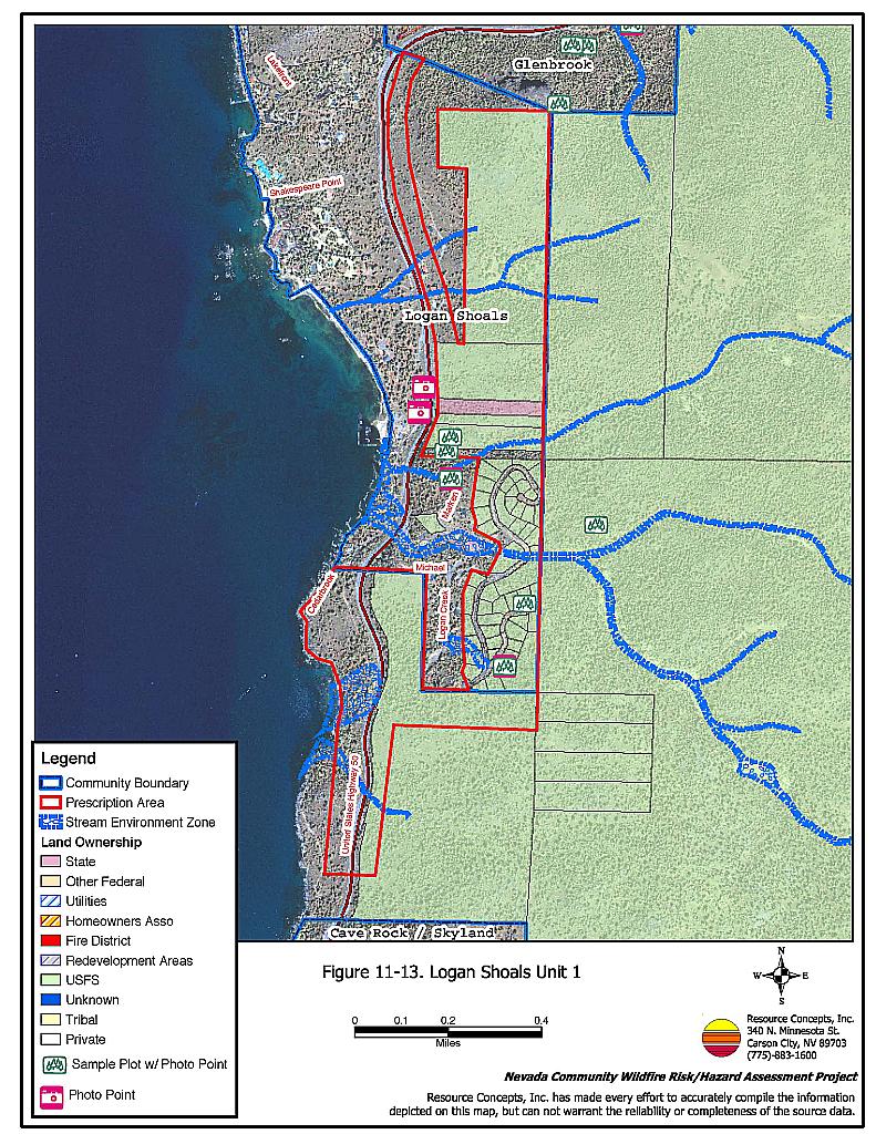
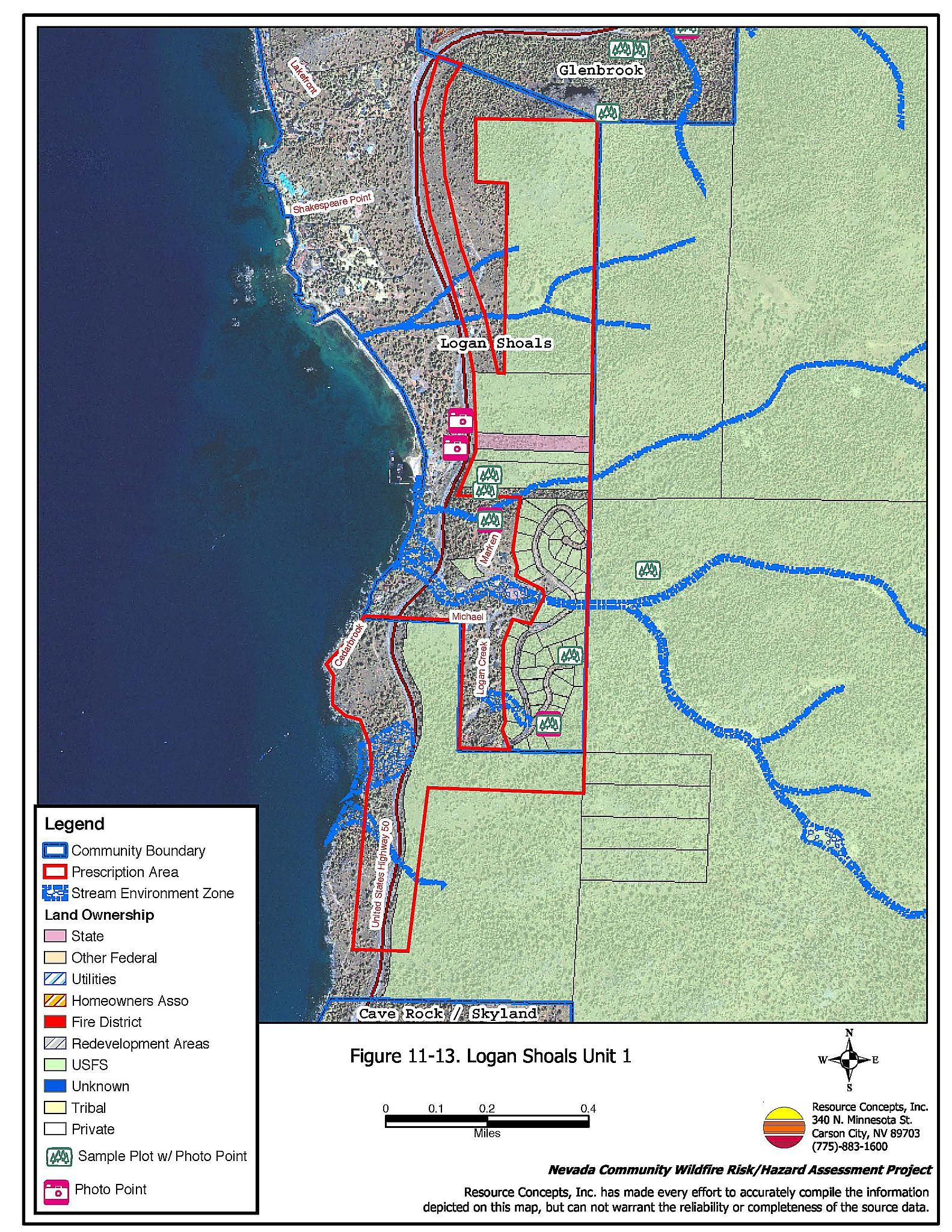
Above Highway 50 and around Logan Shoals. See figure 11-13.
Recommended Mitigation Measures and Scope of Work: Present prescription and work specifications in sufficient detail to facilitate procurement of bids and quotes. For hazardous fuel removal projects include estimated volumes (tons/acre) of fuel removed and disposal plan.
Remove or thin brush understory to lower fire intensity and reduce ladder fuels. Remove dead and down material. Spacing between remaining bushes should be 2-3 times the height of brush and in open areas near trees at least two times the height of the trees. A brush masticator could not be used on most of this project as the slopes are all above 30%. Aerial systems or other steep slope methods should be explored. Grind the brush and leave as mulch, or hand cut, pile, and burn. Use of herbicide could reduce sprouting of some species.
Create a fuel break within the one-quarter mile Wildland Urban Interface (WUI) zone around the community and Highway 50. Thin from below, removing smaller trees and leaving larger ones to achieve the desired stocking rate of 80 to 100 square feet of basal area per acre.
*Prescribed fire could be used to reduce the brush understory, and desired where feasible to return fire to the landscape. It should only be applied in areas after thinning and slash pile burning are complete to maintain fire control.
Evaluation of the Extent to Which Completion of This Project Will Reduce the Fire Threat:
Treatment in this area will help contain human-caused ignitions below the project area, keeping fire from spreading uphill and becoming uncontrollable. It will also protect the private and commercial structures from a downslope fire event. Implementation of the prescription will reduce the competition among residual trees, increasing forest health and decreasing tree mortality. This will reduce the amount of accumulated dead and down material contributing to the fuel loadings on the forest floor, and keep burning material from rolling downhill into the community. It will also help curb the spread of dwarf mistletoe.
If all of the recommendations in this report are implemented, there is still no guarantee that a devastating wildfire will not occur in the area. However, community awareness and individual attention to fuels management on private property and fuel reduction on state, federal, and county property will help to achieve the highest level of wildfire safety possible.
Identification of Protected Species or Other Critical Resources: Describe any measures that must be taken to protect critical wildlife habitat, historic
Environmental compliance measures must be implemented before project initiation. Stream Environment Zones are located in the project area and must be protected, employing appropriate TRPA mitigation measures.
Some threatened and endangered species exist in the Tahoe Basin. Appropriate avoidance and mitigation measures should be employed during project implementation.
Compliance with cultural resource protection may also be necessary. Check with TRPA and the NVSHPO to ensure cultural resources are protected.
Post-project Rehabilitation: Present scope of work in sufficient detail to facilitate procurement of bids and quotes.
Rehabilitate any fire control lines, landings or disturbed areas. Rehabilitation will be minimal if only hand methods are used. Where soil has been disturbed, TRPA rehabilitation measures and Best Management Practices would apply. This could include reseeding or mulching areas if necessary.
Estimated Timeline:
Desirable time of year to complete:
May - December.
Estimated time required to complete project:
One operational season for aerial system. Two to three operational seasons with NDF crews.
Estimated Cost: Present an estimate of the total cost of project completion and the basis for the estimate presented. If the project can be subdivided into phases or various components, present an estimated cost for each.
Cable yarding is recommended, however, no costs for cable yarding were available. The costs below are a minimum based on currently accepted methods in the Tahoe Basin.
| Hand cut, pile, and burn | $2,000 / acre X 243 acres | |
| Prescribed fire within 5 years | $1,200 / acre X 243 acres | |
| Total Cost | $ 777,600 |
Biomass to be removed is approximately 17 tons / acre.
Project Maintenance Requirements:
Project requires periodic maintenance to control volume of brush and other ladder fuels. Hand cut pile and burning or prescribed burning can maintain acceptable levels of ground fuels in project area. Repeat at ten year intervals.
Other Considerations: Describe any other considerations that must be taken into account to successfully complete this project such as permits, clearances, approvals, etc.
- USFS Regional Approval (USFS property)
- TRPA Approval
- Air Quality permit
- Permission to cross private property
- Clearance to open old roads
Typical vegetation condition in prescription area.
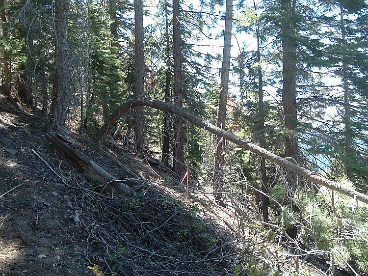
Figure 11-13Proposed Prescription Area Logan Shoals Unit 1 |
 |