![]()
![]()
Table of Contents
- Title Page / County Map
Report
- Executive Summary
- 1.0 Introduction
- 2.0 Methodology
- 3.0 Description of the County
- 4.0 County-Wide Assessment Results
- 5.0 Denio
- 6.0 Denio Junction
- 7.0 Golconda
- 8.0 Grass Valley
- 9.0 McDermitt
- 10.0 Orovada
- 11.0 Paradise Ranchos
- 12.0 Paradise Valley
- 13.0 Quinn River
- 14.0 Valmy
- 15.0 Winnemucca
- 16.0 Fort McDermitt
- 17.0 Conclusions
- 18.0 References
Appendices
- Appendix A - Glossary of Terms Used in Wildfire Management and Scientific Plant Names
- Appendix B - Community Wildfire Assessment Rating System
- Appendix C - Photographs of Representative Fuel Types in Humboldt County Communities
- Appendix D - List of Persons Contacted
- Appendix E - Homeowner Guidelines
- Appendix F - Fire Safe Community Guidelines
Tables
- Table 1-1 Community Risk and Hazard Assessment Results
- Table 2-1 Primary Datasets and Sources Utilized in the Humboldt County Community Wildfire Risk/Hazard Assessment
- Table 2-2 Hazard Rating Point System Used in the Nevada Community Wildfire Risk/Hazard Assessment Project
- Table 3-1 Land Management Acreage Within Humboldt County
- Table 3-2 Summary of Available Fire Occurrence Data and Estimated Acreage, 1980-2003
- Table 3-3 At Risk Historical Places in Humboldt County
- Table 3-4 Federal and State Listed Flora and Fauna At Risk in Humboldt County
- Table 4-1 Humboldt County Risk/Hazard Assessment Results
- Table 4-2 Blm Winnemucca Field Office Wildfire Suppression Resources
- Table 5-1 Denio Wildfire Suppression Resources
- Table 5-2 Denio Priority Recommendations to Reduce Wildfire Risks and Hazards
- Table 5-3 Denio Wildfire Hazard Rating Summary
- Table 6-1 Denio Junction Priority Recommendations to Reduce Wildfire Risks and Hazards
- Table 6-2 Denio Junction Wildfire Hazard Rating Summary
- Table 7-1 Golconda Wildfire Suppression Resources
- Table 7-2 Golconda Priority Recommendations to Reduce Wildfire Risks and Hazards
- Table 7-3 Golconda Wildfire Hazard Rating Summary
- Table 8-1 Grass Valley Wildfire Suppression Resources
- Table 8-2 Grass Valley Priority Recommendations to Reduce Wildfire Risks and Hazards
- Table 8-3 Grass Valley Wildfire Hazard Rating Summary
- Table 9-1 McDermitt Wildfire Suppression Resources
- Table 9-2 McDermitt Priority Recommendations to Reduce Wildfire Risks and Hazards
- Table 9-3 McDermitt Wildfire Hazard Rating Summary
- Table 10-1 Orovada Wildfire Suppression Resources
- Table 10-2 Orovada Priority Recommendations to Reduce Wildfire Risks and Hazards
- Table 10-3 Orovada Wildfire Hazard Rating Summary
- Table 11-1 Paradise Ranchos Wildfire Suppression Resources
- Table 11-2 Paradise Ranchos (Paradise Hills) Priority Recommendations to Reduce Wildfire Risks and Hazards
- Table 11-3 Paradise Ranchos Wildfire Hazard Rating Summary
- Table 12-1 Paradise Valley Wildfire Suppression Resources
- Table 12-2 Paradise Valley Priority Recommendations to Reduce Wildfire Risks and Hazards
- Table 12-3 Paradise Valley Wildfire Hazard Rating Summary
- Table 13-1 Quinn River: Fire Suppression Resources Available
- Table 13-2 Quinn River Priority Recommendations to Reduce Wildfire Risks and Hazards
- Table 14-1 Valmy Wildfire Suppression Resources
- Table 14-2 Valmy Priority Recommendations to Reduce Wildfire Risks and Hazards
- Table 14-3 Valmy Wildfire Hazard Rating Summary
- Table 15-1 Winnemucca Wildfire Suppression Resources
- Table 15-2 Winnemucca Priority Recommendations to Reduce Wildfire Risks and Hazards
- Table 15-3 Winnemucca Wildfire Hazard Rating Summary
- Table 16-1 Fort McDermitt Wildfire Suppression Resources
- Table 16-2 Fort McDermitt Priority Recommendations to Reduce Wildfire Risks and Hazards
Figures
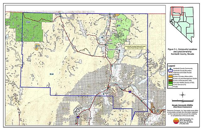
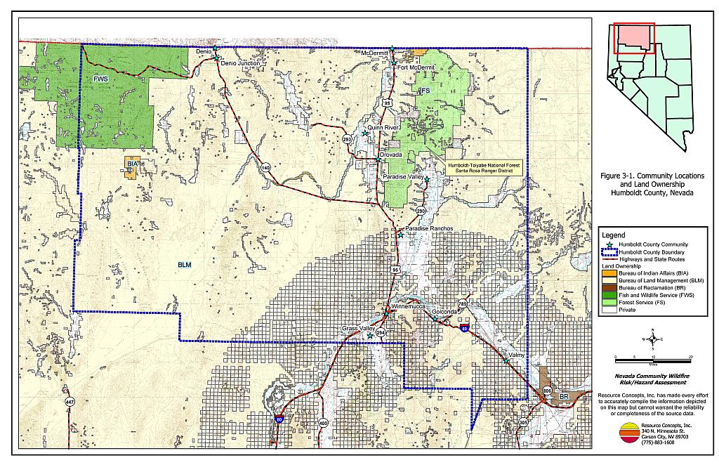
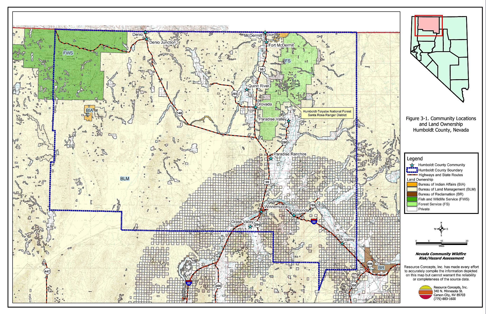
Figure 3-1
Community Locations and Land Ownership, Humboldt County, Nevada
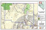
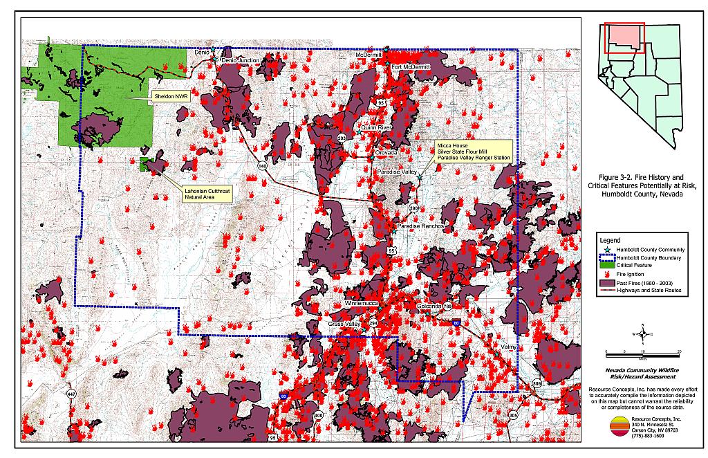
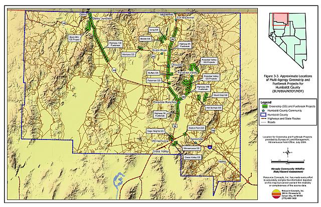
Figure 3-2
Fire History and Critical Features Potentially At Risk, Humboldt County, Nevada
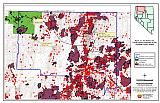
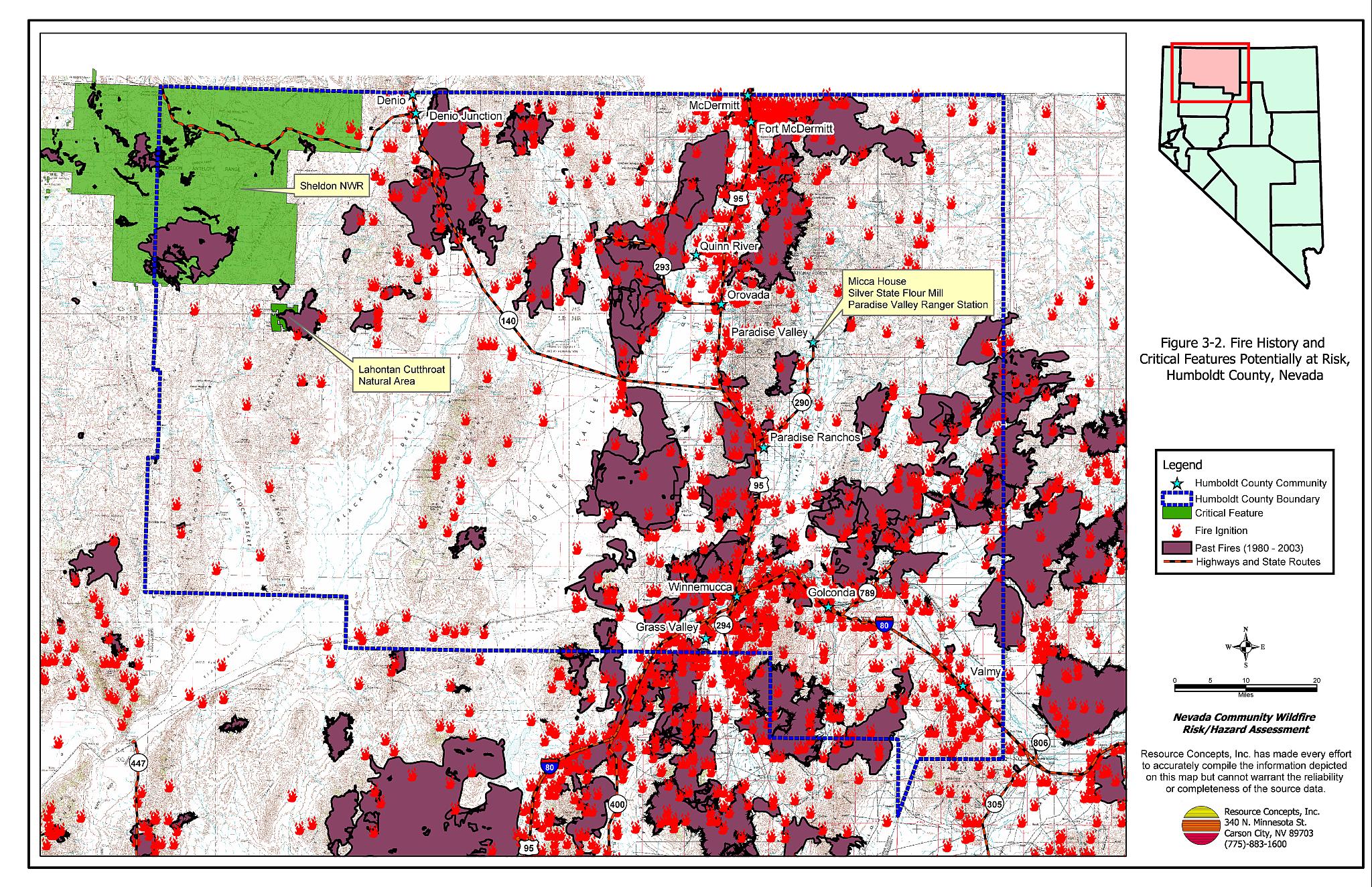
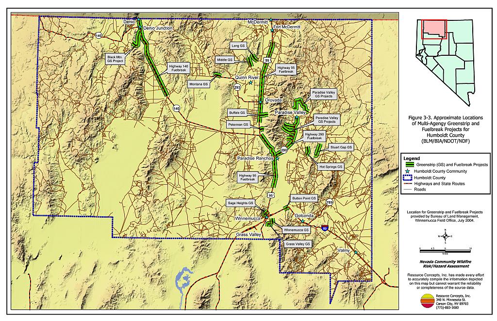
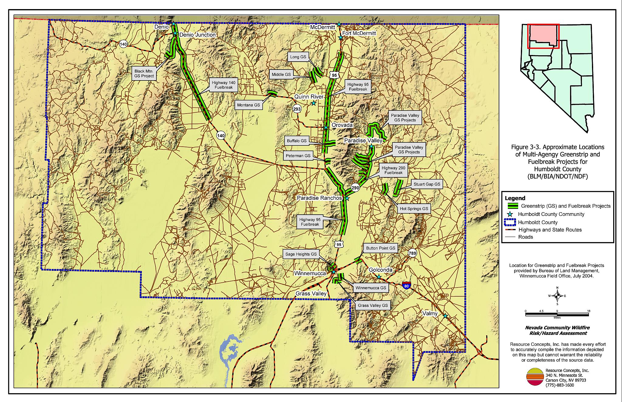
Figure 3-3
Approximate Locations of Multi-agency Greenstrip and Fuelbreak Projects For Humboldt County
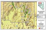
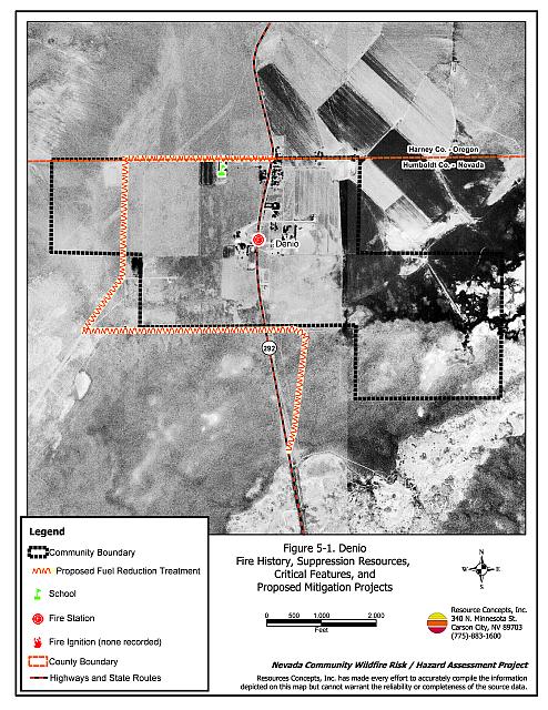
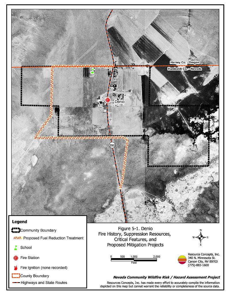
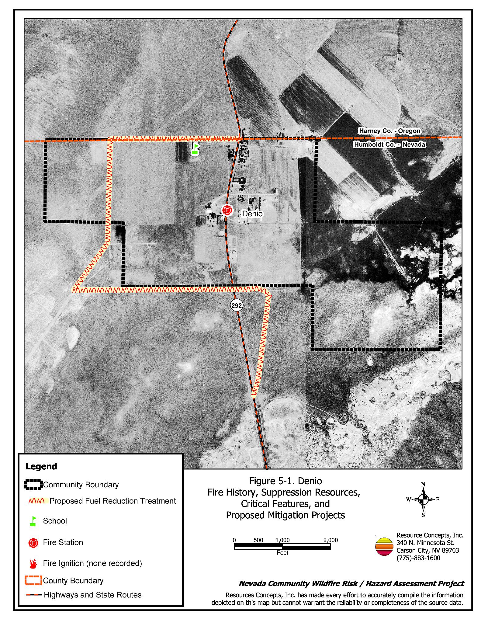
Figure 5-1
Denio Fire History, Suppression Resources, Critical Features, and Proposed Mitigation Projects
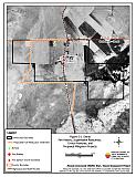
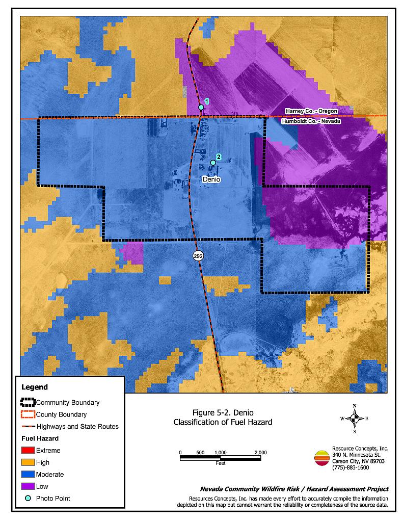
Figure 5-2
Denio Classification of Fuel Hazard
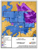
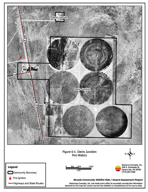
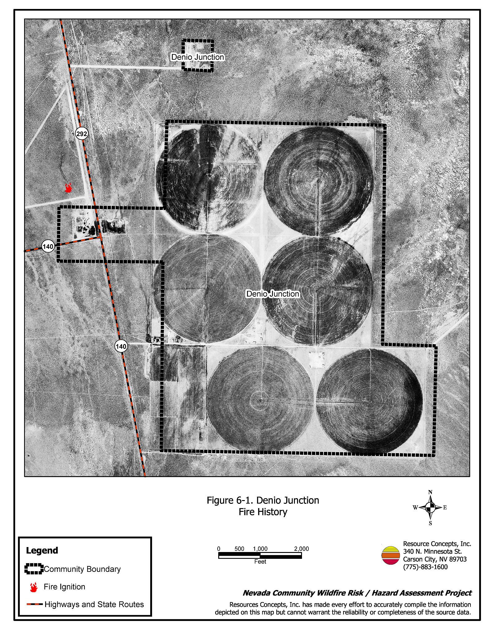
Figure 6-1
Denio Junction Fire History

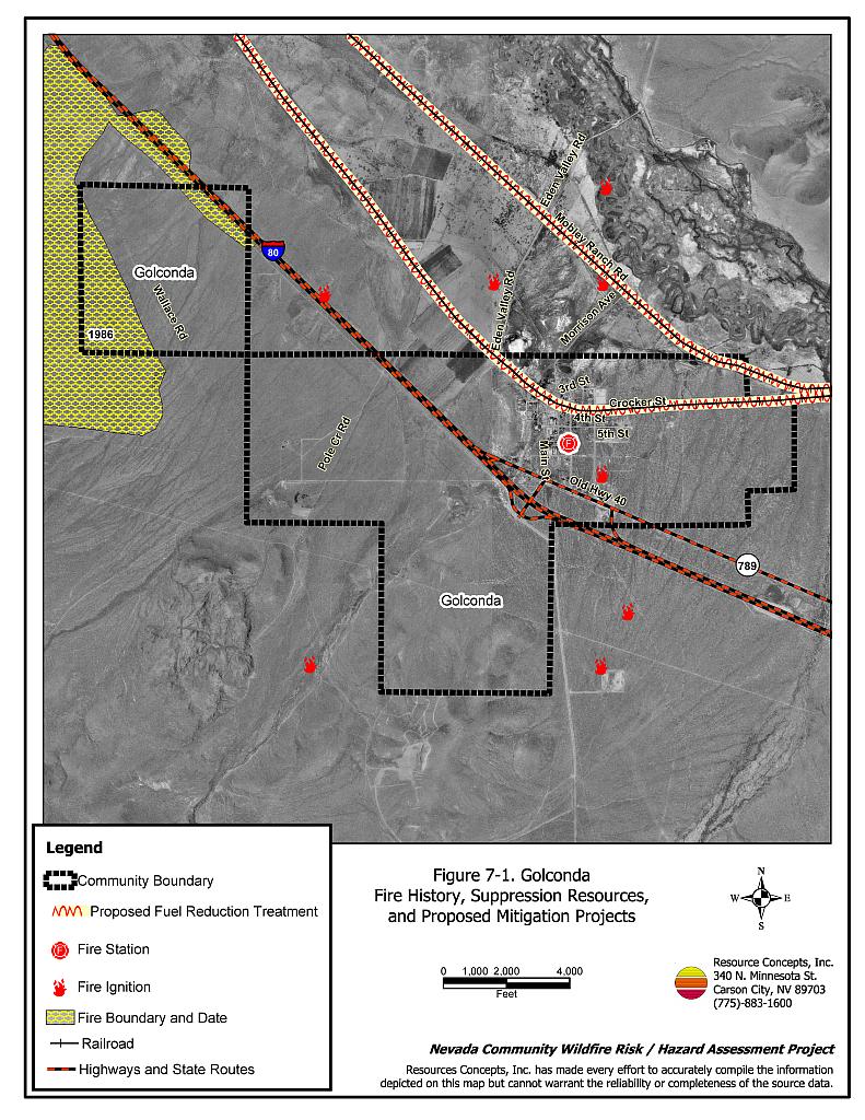
Figure 7-1
Golconda Fire History, Suppression Resources, and Proposed Mitigation Projects

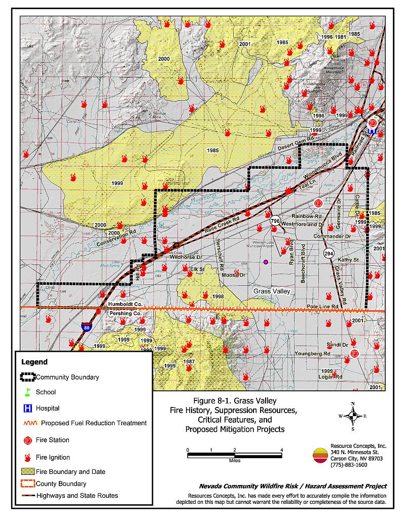
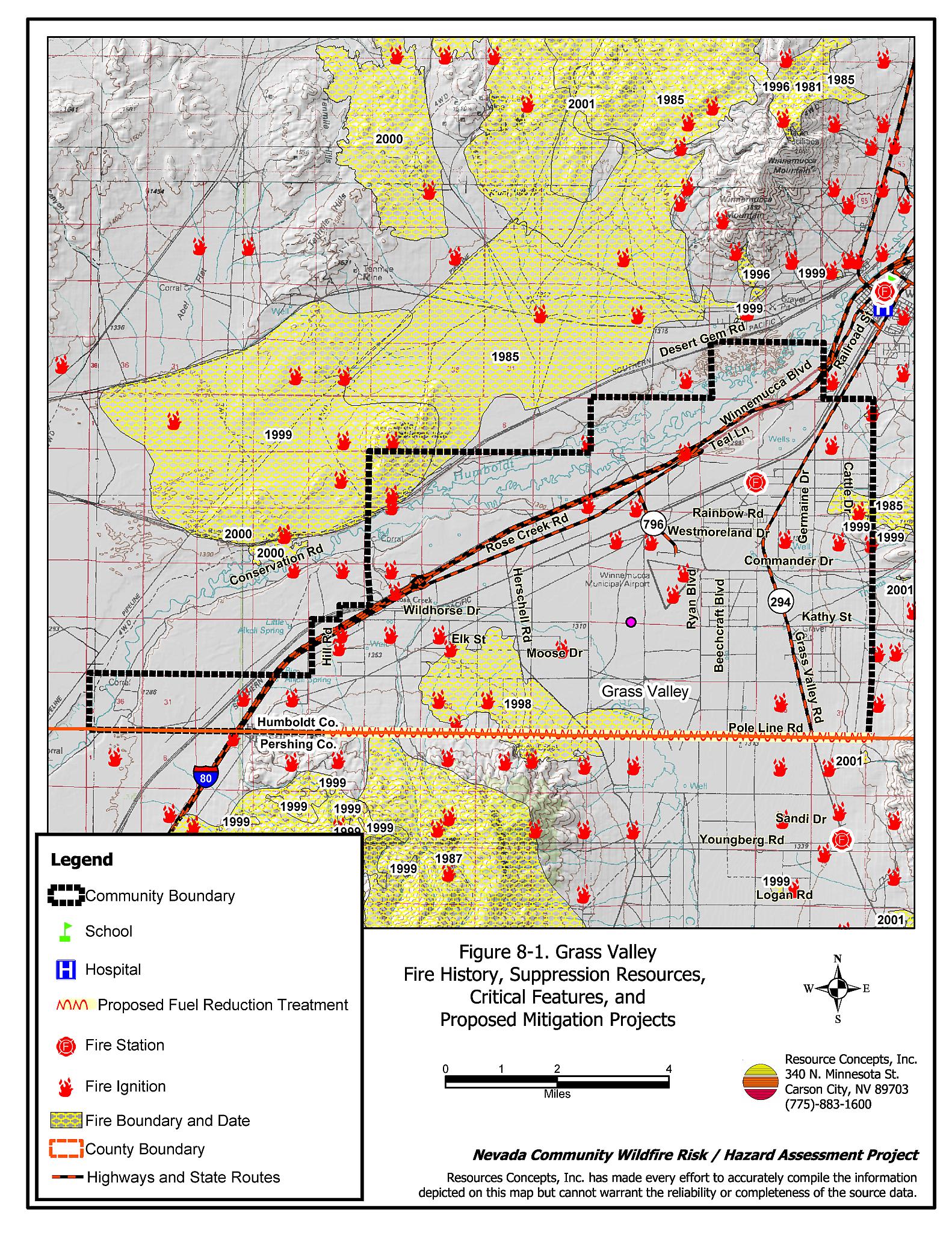
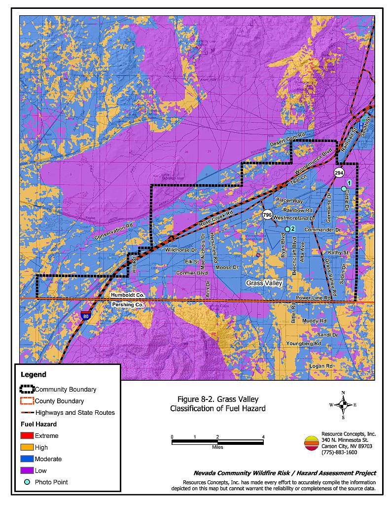
Figure 8-1
Grass Valley Fire History, Suppression Resources, Critical Features, and Proposed Mitigation Projects
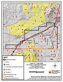
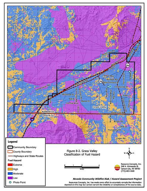
Figure 8-2
Grass Valley Classification of Fuel Hazard
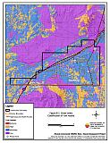
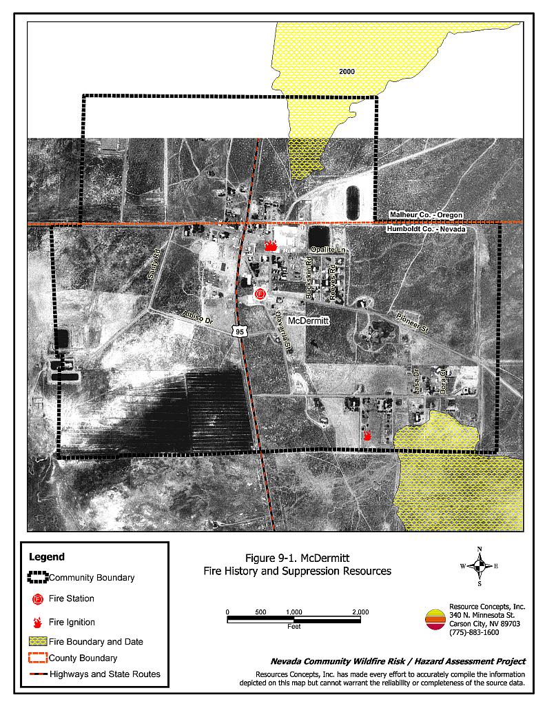
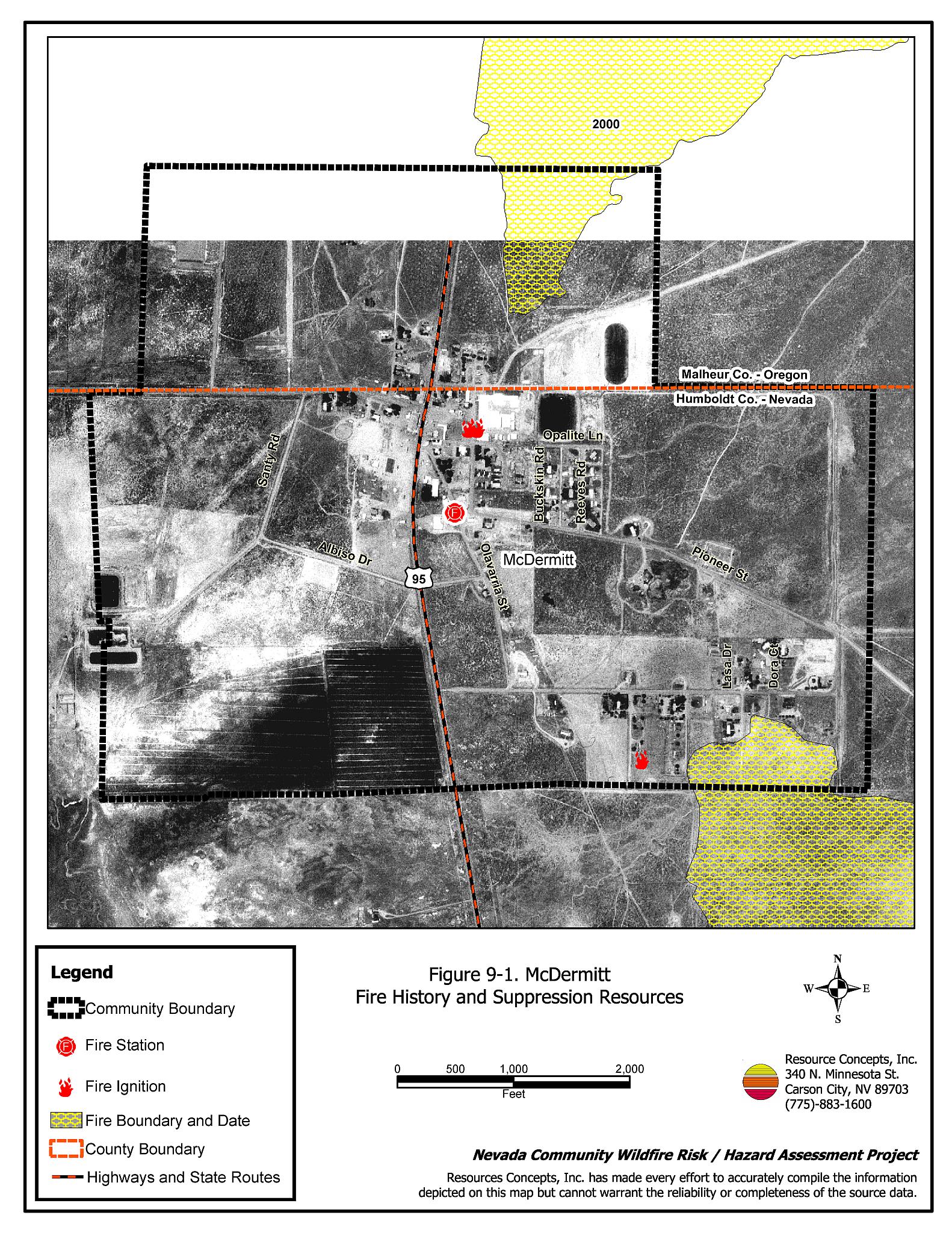
Figure 9-1
McDermitt Fire History and Suppression Resources
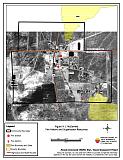
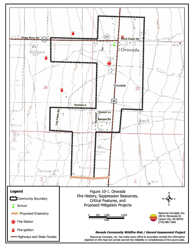
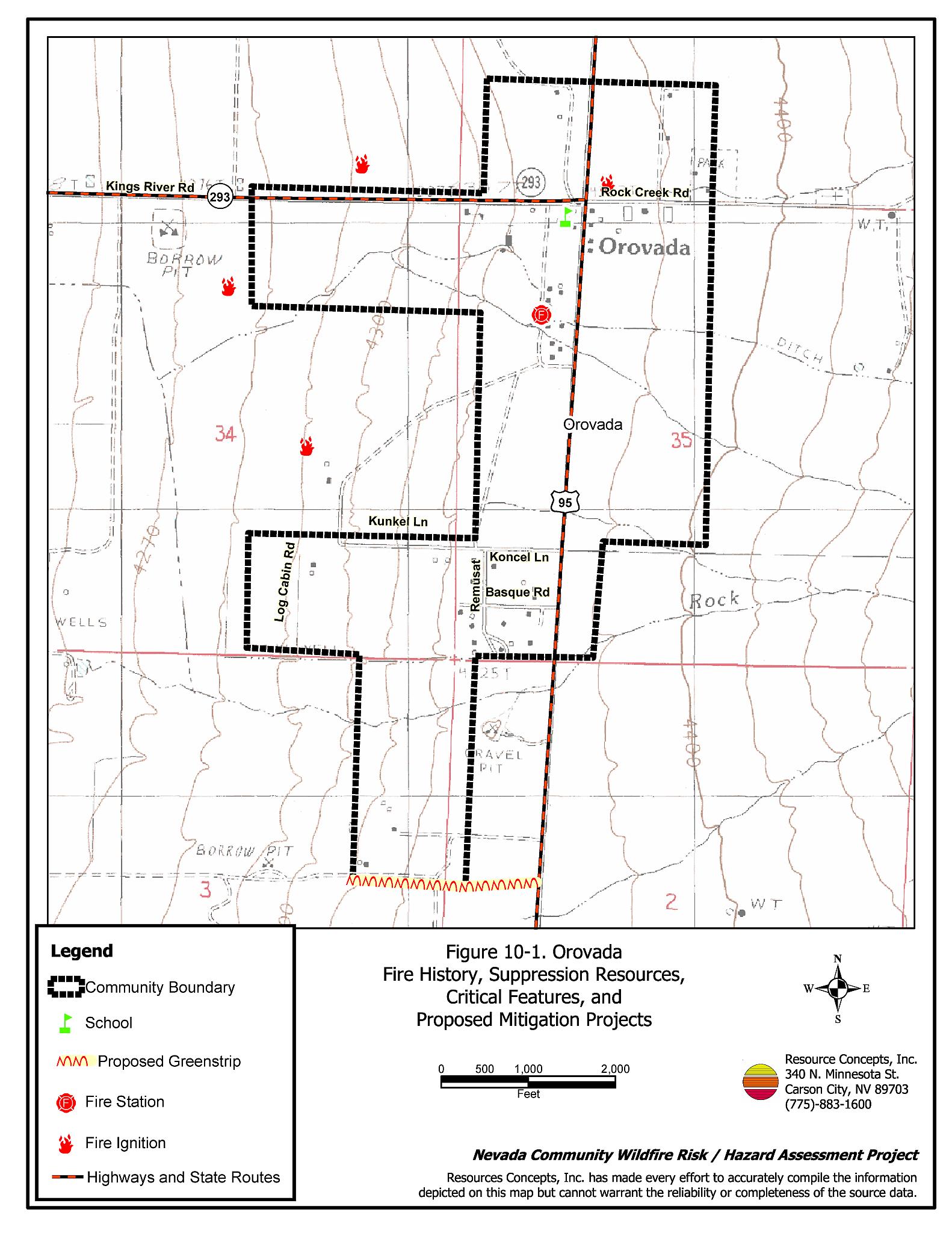
Figure 10-1
Orovada Fire History, Suppression Resources, Critical Features, and Proposed Mitigation Projects
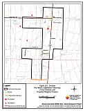
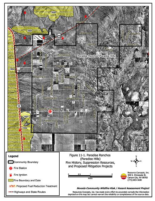
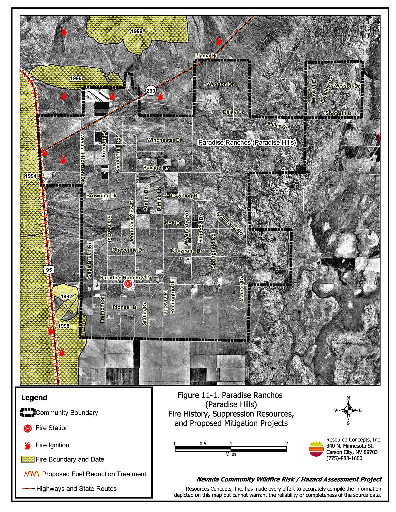
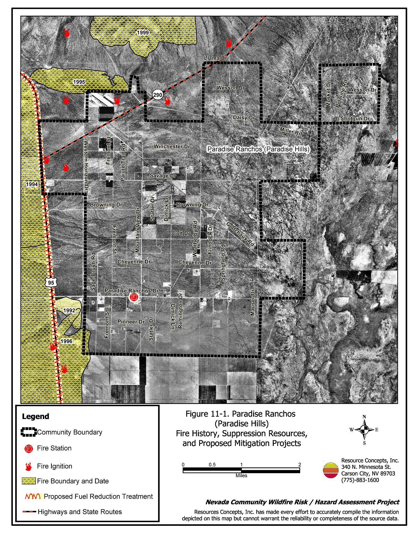
Figure 11-1
Paradise Ranchos (Paradise Hills) Fire History and Suppression Resources
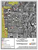
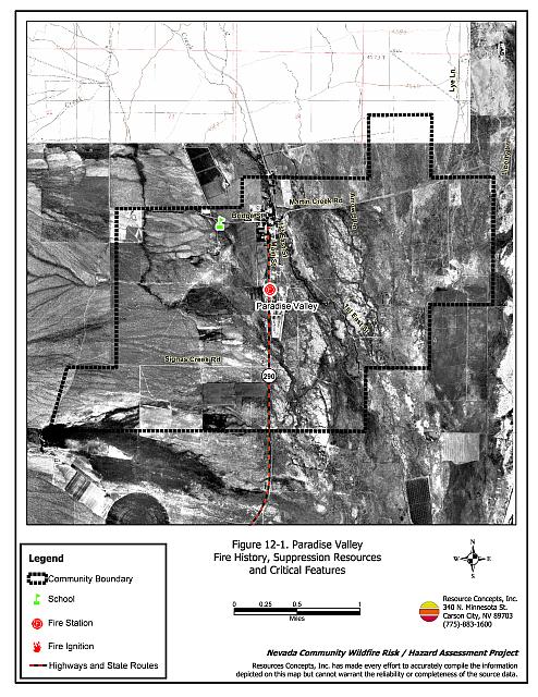
Figure 12-1
Paradise Valley Fire History, Suppression Resources, and Critical Features
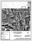
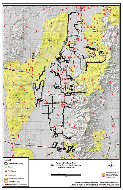
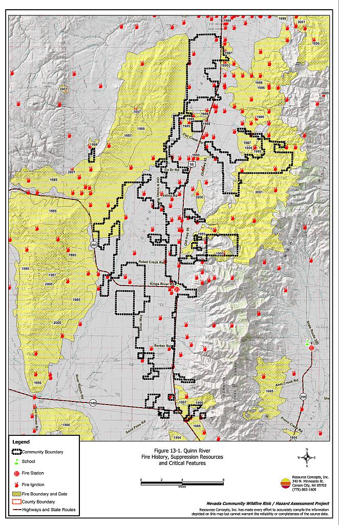
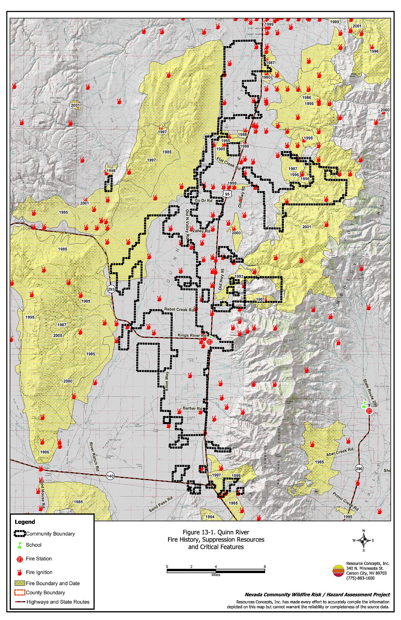
Figure 13-1
Quinn River Fire History, Suppression Resources, and Critical Features
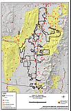
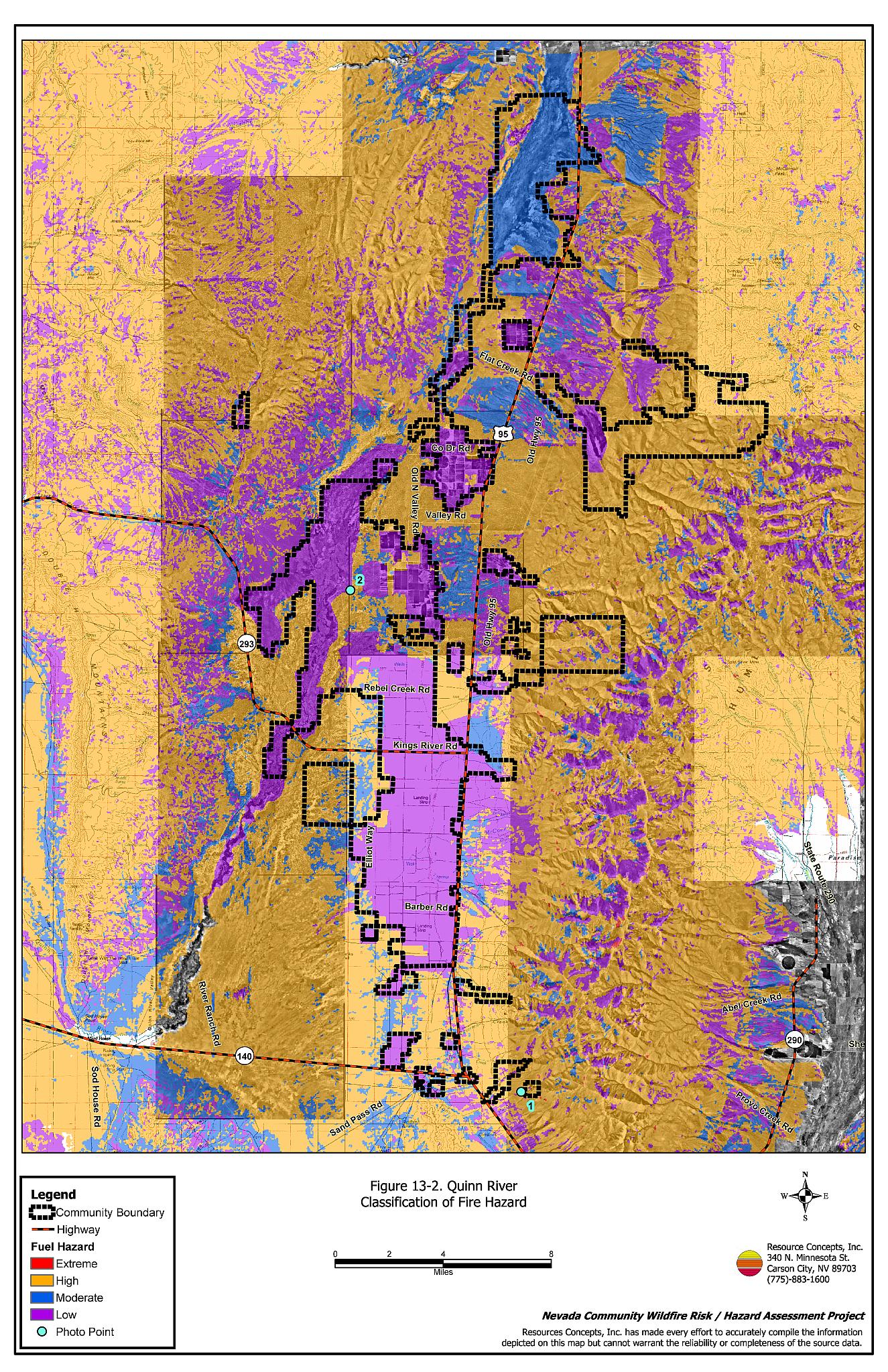
Figure 13-2
Quinn River Classification of Fuel Hazard
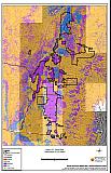
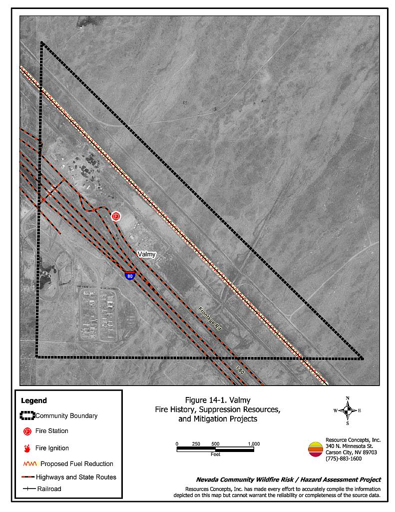
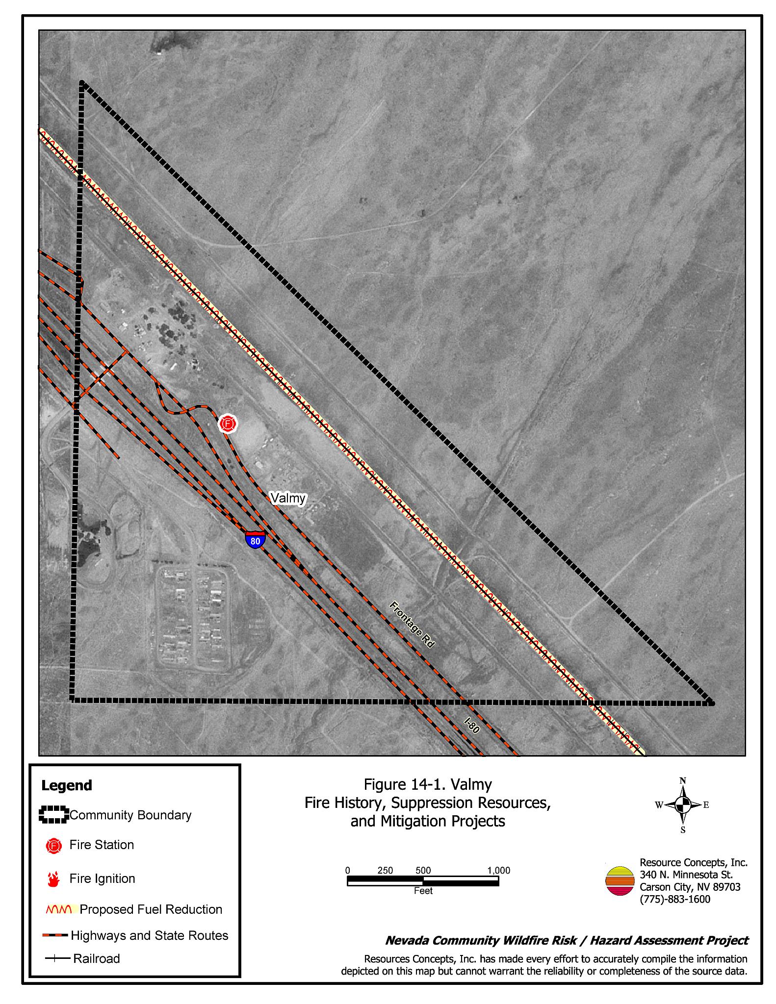
Figure 14-1
Valmy Fire History and Suppression Resources
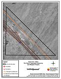
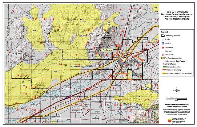
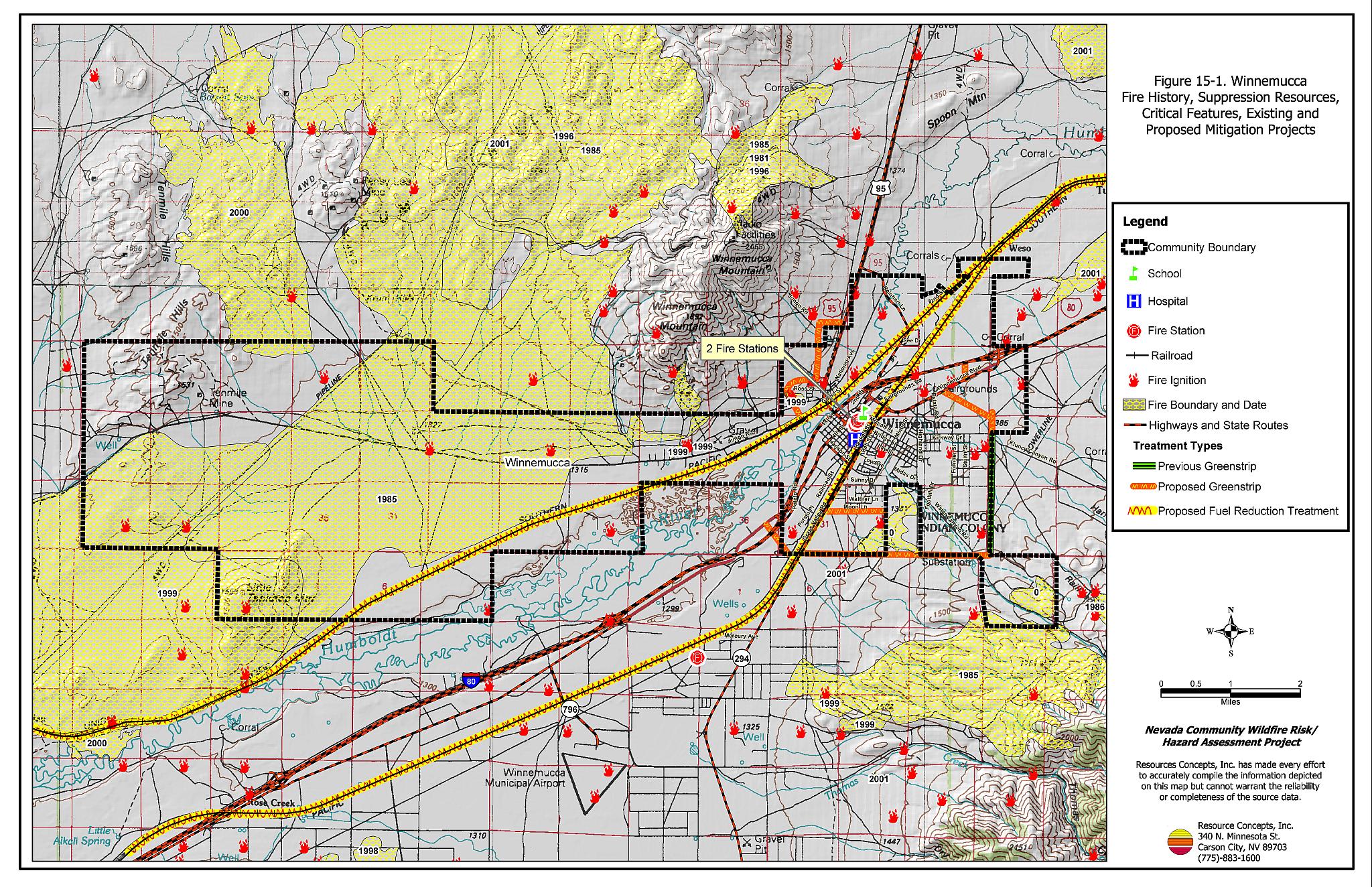
Figure 15-1
Winnemucca Fire History, Suppression Resources, Critical Features, and Existing and Proposed Mitigation Projects
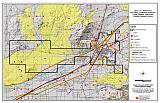
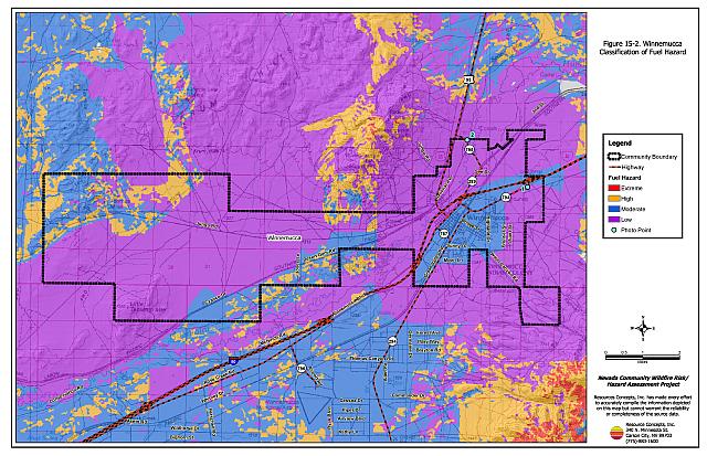
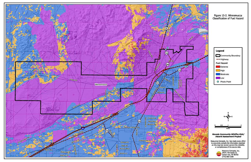
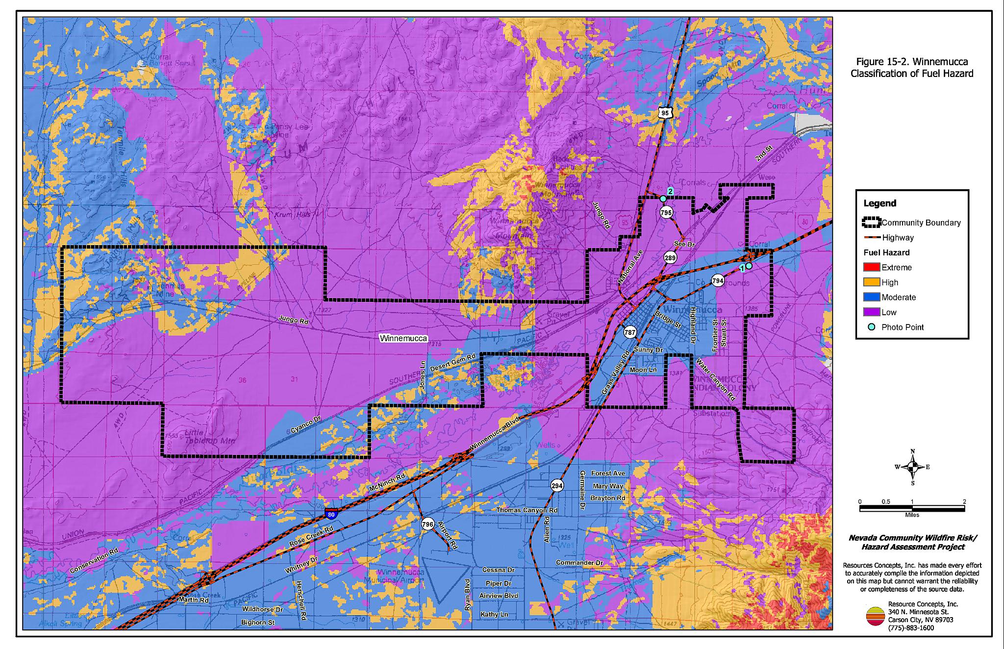
Figure 15-2
Winnemucca Classification of Fuel Hazards
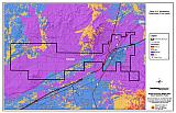
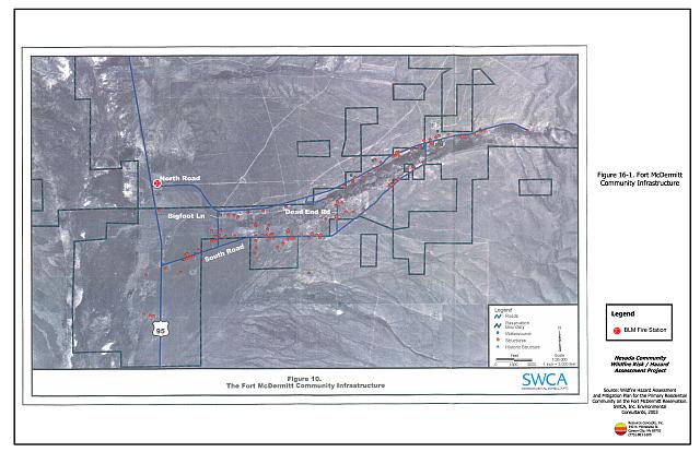
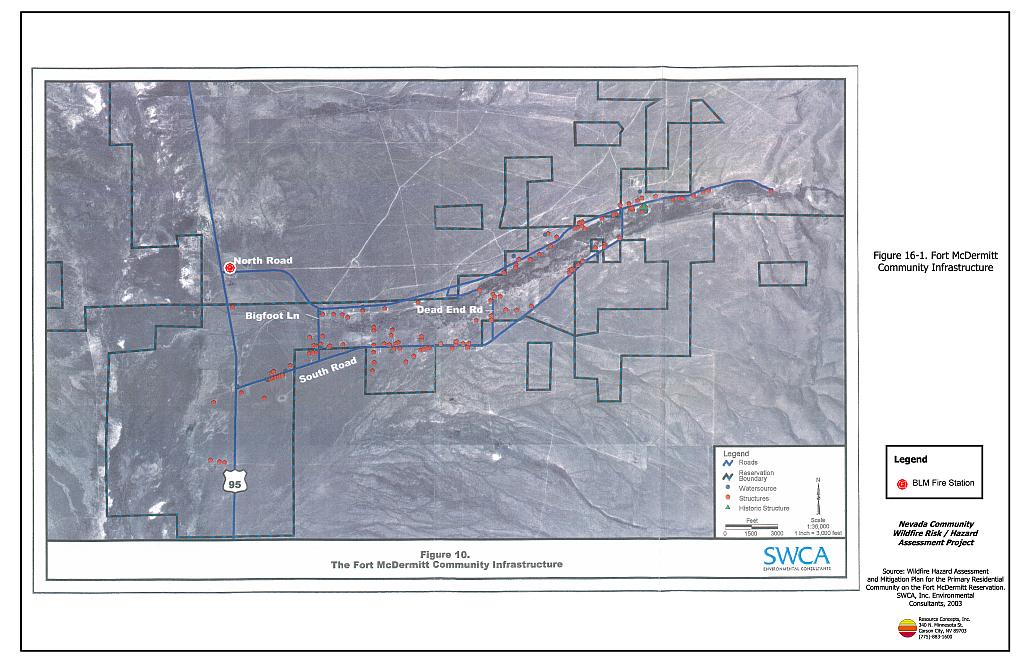
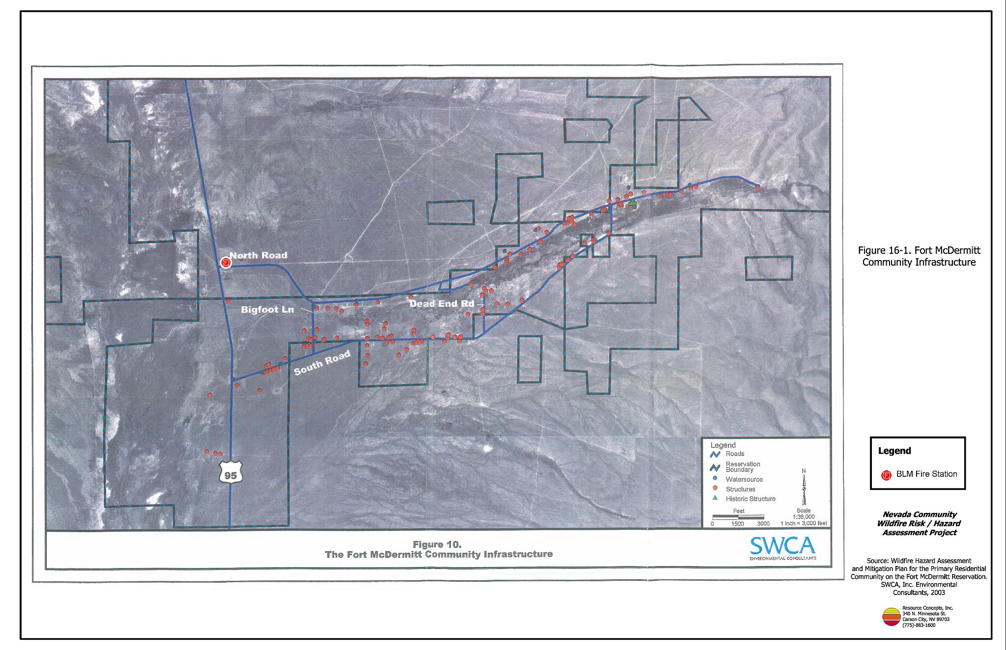
Figure 16-1
Fort McDermitt Community infrastructure
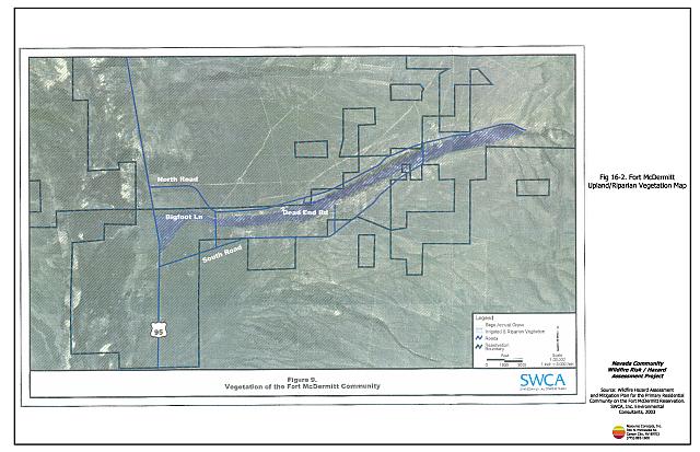
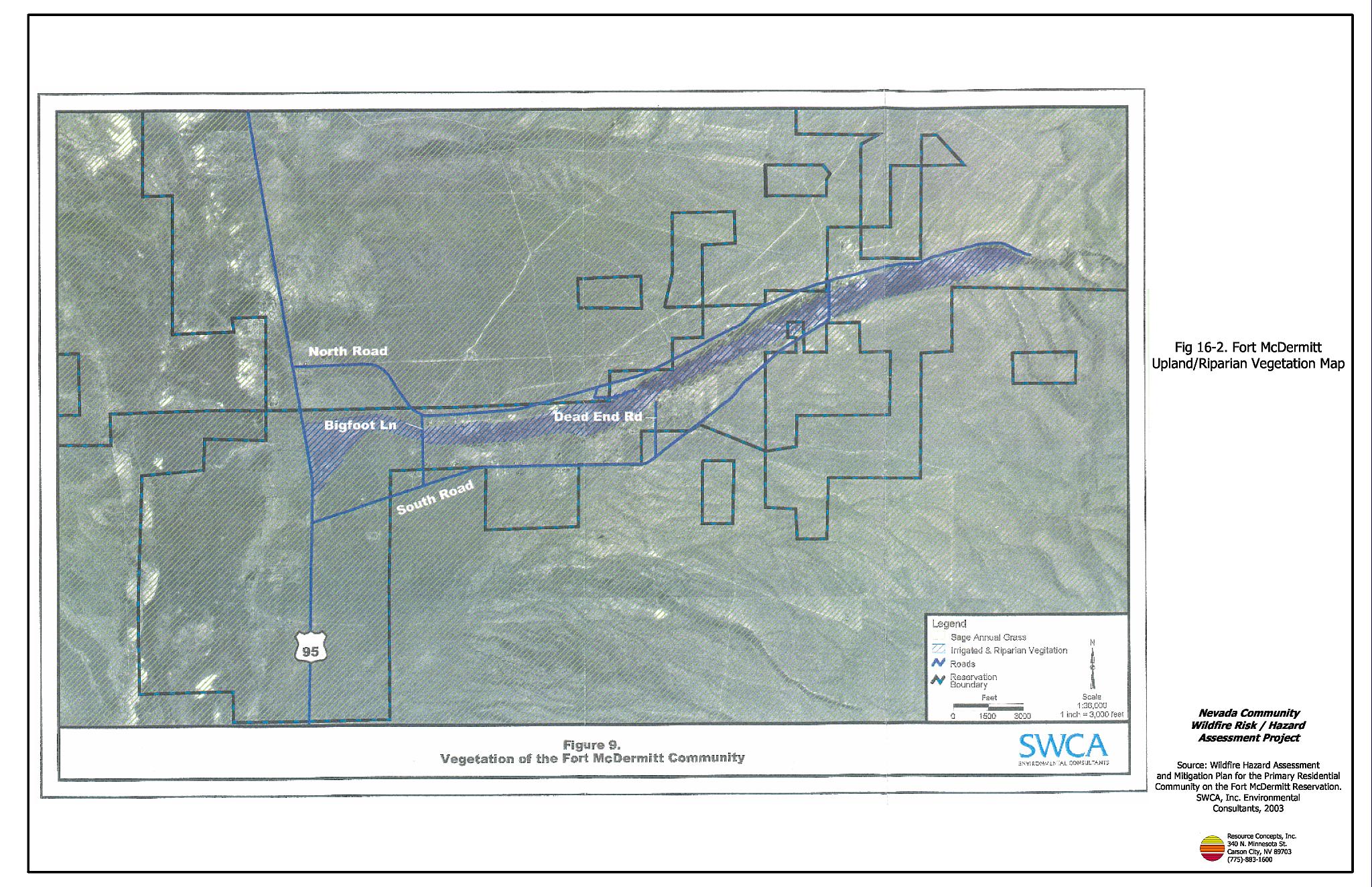
Figure 16-2
Fort McDermitt Upland/riparian Vegetation Map

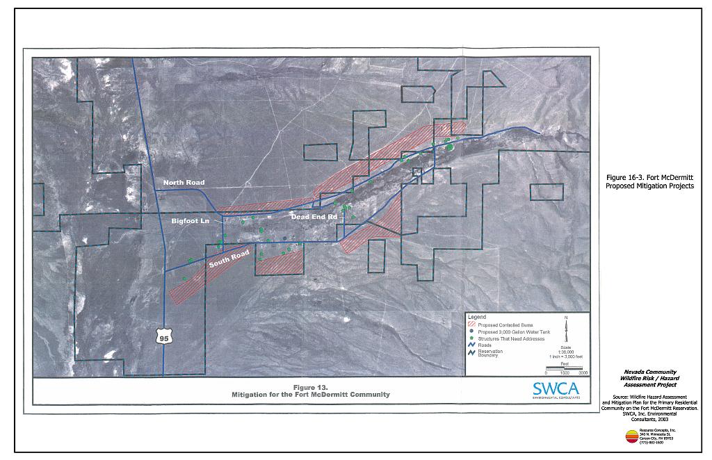
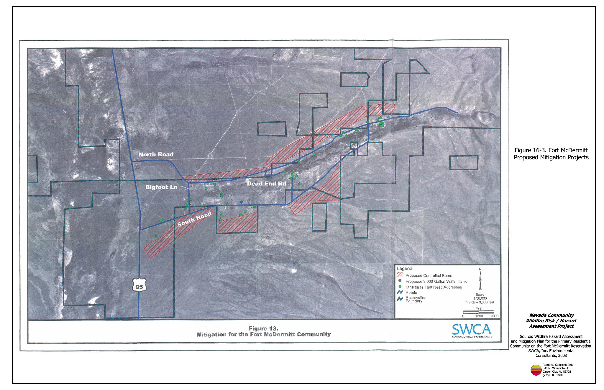
Figure 16-3
Fort McDermitt Proposed Mitigation Projects